Category:17th-century architecture in Oxfordshire
Jump to navigation
Jump to search
Subcategories
This category has the following 46 subcategories, out of 46 total.
*
A
- Abingdon County Hall (49 F)
B
- Unicorn Hotel, Banbury (11 F)
- Bell Hotel, Faringdon (5 F)
- 17 Market Square, Bicester (2 F)
- 47 Market Square, Bicester (6 F)
- Blacks Head, Bletchingdon (7 F)
- Great Tree Farm Barn (12 F)
- Blue Boar, Longworth (7 F)
C
- Carfax Conduit (9 F)
- Chastleton House Gateway (11 F)
- The Crown, Nuffield (6 F)
- Crown Hotel, Faringdon (7 F)
E
- Eagle Vaults, Witney (3 F)
- Eyston Arms, East Hendred (3 F)
F
- Old Town Hall, Faringdon (16 F)
G
H
- Heyford Bridge (5 F)
K
- Kiddington Hall Dovecote (3 F)
- King's Arms, Gosford (4 F)
L
- The Leathern Bottle, Lewknor (2 F)
M
- The Mitre, Oxford (12 F)
N
- Nettlebed Kiln (3 F)
- Nut Tree, Murcott (3 F)
P
- The Plough, West Hanney (3 F)
R
- Red Lion, Blewbury (6 F)
- Red Lion, Brightwell-cum-Sotwell (10 F)
- Reindeer Inn, Banbury (21 F)
- The Royal Oak, Burford (10 F)
S
- Smiths Farm, Didcot (6 F)
- Star Inn, Stanton St John (4 F)
T
- Tom Brown's School Museum (4 F)
- The Trout, Wolvercote, Oxford (51 F)
W
- Wallingford Town Hall (35 F)
- Water Eaton Dovecote (6 F)
- Watlington Town Hall (10 F)
- The Wheatsheaf, East Hendred (5 F)
- The White Hart, Nettlebed (3 F)
- Wroxton guide post (6 F)
Media in category "17th-century architecture in Oxfordshire"
The following 97 files are in this category, out of 97 total.
-
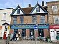 102 High Street, Thame, December 2023.jpg 4,032 × 3,024; 4.19 MB
-
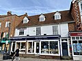 110 and 111 High Street, Thame, December 2023.jpg 4,032 × 3,024; 3.93 MB
-
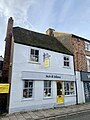
 17 Buttermarket, Thame, December 2023.jpg 4,032 × 3,024; 3.26 MB
-
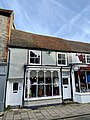
 18 Buttermarket, Thame, December 2023.jpg 3,024 × 4,032; 3.18 MB
-
 3 Upper High Street, Thame, December 2023.jpg 3,024 × 4,032; 3.2 MB
-
 9 and 10 Buttermarket, Thame, December 2023.jpg 4,032 × 3,024; 4.08 MB
-
 9 Buttermarket, Thame, December 2023.jpg 3,024 × 4,032; 3.4 MB
-
 Abingdon CrownAndThistle.jpg 1,280 × 649; 401 KB
-
 Appleton NethertonRd Barn.JPG 2,700 × 1,800; 1.65 MB
-
 Appleton StLawrence SouthPorch.JPG 1,988 × 2,781; 2.71 MB
-
 Church View, Bampton - geograph.org.uk - 1542237.jpg 640 × 427; 119 KB
-
 The Library-Bampton.JPG 3,872 × 2,592; 2.39 MB
-
 Blackhorse Cottage, Watlington.jpg 1,000 × 750; 111 KB
-
 Blagrave Farmhouse, Old Didcot.jpg 900 × 675; 270 KB
-
 Bletchingdon OldRedLion.JPG 3,000 × 1,800; 2.3 MB
-
 Bletchingdon StGiles porch.JPG 960 × 1,280; 721 KB
-
 Blewbury AshbrookMews SSW.jpg 1,280 × 616; 463 KB
-

-
 Broadwell "dole pillars" - geograph.org.uk - 363204.jpg 640 × 480; 107 KB
-
 St Peter, Bucknell, Oxon - Pulpit - geograph.org.uk - 1634587.jpg 480 × 640; 80 KB
-
 The Trigger Pond pub, Bucknell - geograph.org.uk - 64196.jpg 640 × 480; 111 KB
-
 Chalgrove StMaryV Font.JPG 1,950 × 2,925; 1.98 MB
-

-
 The tower of Chastleton Church - geograph.org.uk - 901446.jpg 426 × 640; 106 KB
-
 Gateway to Chipping Norton Almshouses - geograph.org.uk - 238605.jpg 480 × 640; 59 KB
-
 Churchyard 17th-century gateway at All Saints' Church, Churchill, Oxfordshire.jpg 2,120 × 2,816; 1.36 MB
-
 Cottage by the barn - geograph.org.uk - 1725808.jpg 1,024 × 683; 159 KB
-

-
 Crossways, Aston Tirrold.jpg 900 × 675; 313 KB
-
 Deddington SSPeter&Paul NorthPorch SaucerVault.jpg 1,280 × 719; 561 KB
-
 Godfreys Farm - geograph.org.uk - 1639788.jpg 640 × 480; 104 KB
-
 The Plough East Hendred Stevage.jpeg 2,359 × 1,564; 1.38 MB
-
 The Wheatsheaf in East Hendred - geograph.org.uk - 1308802.jpg 640 × 427; 73 KB
-
 The Highwayman, Exlade Street - geograph.org.uk - 37074.jpg 640 × 481; 214 KB
-
 Fred C Palmer 8209 Orchard House Stanford in the Vale Oxfordshire England.jpg 1,550 × 917; 992 KB
-
 GreatFaringdon MarketPlace 23-24.JPG 3,000 × 2,000; 2.31 MB
-
 GreatHaseley StPeter pulpit.JPG 1,755 × 2,925; 2.3 MB
-
 GreatTew StMichael gateway.JPG 1,965 × 2,620; 845 KB
-
 Greys Court, Henley-on-Thames (6227998844).jpg 4,272 × 2,848; 9 MB
-
 King William, Hailey - geograph.org.uk - 1007239.jpg 640 × 427; 169 KB
-
 The Old Brewery in Harwell - geograph.org.uk - 1315547.jpg 640 × 333; 41 KB
-
 The White Hart in Harwell - geograph.org.uk - 1315555.jpg 640 × 427; 79 KB
-
 Headington StAndrews exterior.JPG 2,925 × 1,950; 675 KB
-
 Iffley Rectory SSE.jpg 1,024 × 683; 440 KB
-
 Iffley RectorySE.jpg 1,024 × 732; 430 KB
-
 Islip StNicholasTheConfessor ChestTomb.jpg 2,910 × 1,940; 2.61 MB
-
 Islip StNicholasTheConfessor E.JPG 2,500 × 2,000; 2.37 MB
-
 Kidlington Barn being Renovated - geograph.org.uk - 966389.jpg 640 × 294; 43 KB
-
 KingstonLisle StJohnB screen detail.jpg 1,280 × 853; 686 KB
-
 LangfordOxon StMatthew uplpit.JPG 1,960 × 2,940; 2.52 MB
-

-
 MarshBaldon pulpit.JPG 2,000 × 3,000; 2.45 MB
-

-

-

-
 Conduit House Harcourt Hill Geograph-2162812-by-Des-Blenkinsopp.jpg 3,648 × 2,736; 2.87 MB
-
 Northmoor StDenys Nave&Tower south.jpg 2,925 × 1,950; 2.22 MB
-
 Northmoor StDenys NaveSouth.jpg 3,000 × 2,000; 2.96 MB
-
 Northmoor StDenys NaveWest.jpg 2,925 × 1,950; 2.02 MB
-
 Northmoor StDenys south 30612.jpg 3,000 × 2,000; 2.79 MB
-
 Barns at English Farm - geograph.org.uk - 595125.jpg 640 × 477; 81 KB
-
 Converted barn at English Farm - geograph.org.uk - 595118.jpg 640 × 477; 67 KB
-
 Nuffield EnglishFarm EastRange SSW.jpg 1,280 × 641; 357 KB
-
 Nuffield EnglishFarm EastRange WSW.jpg 1,280 × 720; 394 KB
-
 Nuffield EnglishFarm WestBarn west.jpg 1,275 × 1,280; 705 KB
-
 Old House, Harwell Village - geograph.org.uk - 1946906.jpg 3,648 × 2,736; 2.58 MB
-
 Old Manor House, Shutford - geograph.org.uk - 375472.jpg 640 × 480; 142 KB
-
 South porch date stone at St Thomas the Martyr's Church, Oxford.jpg 450 × 600; 78 KB
-
 St Thomas the Martyr's Church, Oxford - south porch gable.jpg 2,736 × 3,648; 4.42 MB
-
 The Crown Pub in Pishill - geograph.org.uk - 408661.jpg 640 × 480; 115 KB
-
 Radley StJames ChestTomb.JPG 3,008 × 2,000; 2.63 MB
-

-
 St. Faith's, Shellingford.jpg 2,736 × 3,648; 4.32 MB
-
 Shellingford StFaith PorchGable.jpg 683 × 1,024; 569 KB
-
 Shellingford StFaith SE.jpg 1,024 × 614; 320 KB
-
 Shrivenham StAndrew pulpit.JPG 1,800 × 3,000; 2.65 MB
-
 SteepleAston SSPeter&Paul E.jpg 2,955 × 1,970; 1.98 MB
-
 The Cherry Tree, Stoke Row - geograph.org.uk - 36354.jpg 640 × 481; 60 KB
-
 Sydenham RydersFarmBarn.jpg 3,000 × 2,000; 2.37 MB
-
 Thames House, Wallingford.jpg 1,200 × 900; 209 KB
-
 Thatched cottages,Mollington - geograph.org.uk - 131146.jpg 640 × 518; 131 KB
-
 The jetty,Mollington - geograph.org.uk - 131144.jpg 480 × 640; 167 KB
-
 The Thatch, Watlington.jpg 1,000 × 750; 130 KB
-
 Barn by the corner - geograph.org.uk - 934815.jpg 640 × 426; 99 KB
-
 Cottage on the corner - geograph.org.uk - 934477.jpg 640 × 426; 91 KB
-
 Cottage on the corner - geograph.org.uk - 934479.jpg 426 × 640; 80 KB
-
 Porch of Angier's Almshouses, Wallingford, Oxfordshire.jpg 1,024 × 768; 177 KB
-
 Walnuts - Brightwell cum Sotwell(1).jpg 3,264 × 2,448; 1.37 MB
-

-
 Waterperry StMaryV Monument Curson.JPG 1,700 × 2,700; 1.51 MB
-
 Waterperry StMaryV Pulpit+RoodDoorways.jpg 1,940 × 2,910; 1.98 MB
-
 Waterperry StMaryV PulpitFront.jpg 1,920 × 2,880; 2.07 MB
-
 Waterperry StMaryV PulpitOblique.jpg 1,755 × 2,925; 1.79 MB
-
 Wendlebury RedLion.JPG 3,000 × 1,800; 525 KB
-
 Witney HighSt 1–5.jpg 1,280 × 630; 515 KB
-
 Wootton StPeter Sundial.jpg 1,800 × 2,700; 2.56 MB
-
 Yarnton StBartholomew SpencerChapel.JPG 2,940 × 1,960; 2.32 MB


.jpg)


.jpg)


