Category:1792 maps of Africa
Appearance
Temperate regions: North America · South America · Africa · Europe · Asia · – Polar regions: – Other regions:
| ← 1790 1791 1792 1793 1794 1795 1796 1797 1798 1799 → |
Media in category "1792 maps of Africa"
The following 10 files are in this category, out of 10 total.
-
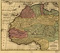
Map of Barbary, Nigritia and Guinea WDL53.png 1,162 × 1,024; 2.56 MB
-
Africa, 1792 - DPLA - a7053ec09cf1f4d49d4dbcc6d4284f94.jpg 1,000 × 942; 282 KB
-
AMH-2552-NA Map of Saldanha bay.jpg 2,400 × 1,607; 635 KB
-
Carte de la Barbarie, le la Nigritie et del la Guinée LOC 98687196.jpg 6,932 × 6,105; 8.24 MB
-
Carte de la Barbarie, le la Nigritie et del la Guinée LOC 98687196.tif 6,932 × 6,105; 121.08 MB
-
Life-expectancy,Africa,1792.svg 850 × 691; 152 KB
-
Map - Special Collections University of Amsterdam - OTM- HB-KZL 33.21.13.tif 7,808 × 6,705; 149.78 MB


