Category:1791 maps of Canada
Jump to navigation
Jump to search
| 1790 1791 1792 1793 1794 1795 1797 1798 → |
English: Maps of Canada from 1791 or related to Canada in 1791
Français : Les cartes du Canada de 1791 ou se rapportant au Canada en 1791
Subcategories
This category has the following 2 subcategories, out of 2 total.
Q
- 1791 maps of Quebec (1 F)
Media in category "1791 maps of Canada"
The following 4 files are in this category, out of 4 total.
-
 A new and accurate map of Quebec and its boundaries from a late survey. LOC 2017593666.jpg 5,470 × 5,197; 3.04 MB
-
 Carte des pays situes à l'ouest du Canada 1791.jpg 1,920 × 1,376; 894 KB
-

-
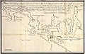 Plano del Archipielago de Clayocuat 1791.jpg 1,900 × 1,200; 1.86 MB


