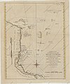
Category:1780s maps of Belize
Jump to navigation
Jump to search
{{#ifexist: Category:{{{British Honduras in the 1780s | [[Category:Template:British Honduras in the 1780s
Subcategories
This category has only the following subcategory.
Media in category "1780s maps of Belize"
The following 2 files are in this category, out of 2 total.
-
1783 map of British territory in the Yucatan.jpg 1,600 × 1,095; 1.49 MB

