Category:1779 maps of the United States
Jump to navigation
Jump to search
Countries of the Americas: Canada · United States of America
States of the United States: New York · Pennsylvania
Subcategories
This category has the following 2 subcategories, out of 2 total.
N
- 1779 maps of New York (state) (13 F)
P
Media in category "1779 maps of the United States"
The following 9 files are in this category, out of 9 total.
-

-
 A chart of Delawar Bay, with soundings and nautical observations. LOC 77692984.jpg 6,525 × 8,980; 9.09 MB
-
 A chart of Delawar Bay, with soundings and nautical observations. LOC 77692984.tif 6,525 × 8,980; 167.64 MB
-

-
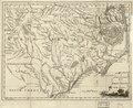 A new and accurate map of North Carolina in North America. LOC 2013593295.tif 4,328 × 3,550; 43.96 MB
-
 A section of a 1779 map of Lake Champlain showing Chimney Point and Crown Point.png 700 × 1,039; 1.02 MB
-
 Map of the English invasion of New Haven Connecticut July 1779.jpg 465 × 750; 35 KB
-

-
 San Gabriel.jpg 2,144 × 1,777; 755 KB


.jpg)
