Category:1776 in Bretagne
Jump to navigation
Jump to search
Administrative regions and territorial collectivity of Metropolitan France (‡ since start of 2016):
Auvergne-Rhône-Alpes‡ · Brittany · Hauts-de-France‡ · Île-de-France · Occitania‡
Former administrative regions of Metropolitan France (until end of 2015):
Alsace
Overseas departments and regions: Guadeloupe · Martinique
Overseas collectivities: French Polynesia
Auvergne-Rhône-Alpes‡ · Brittany · Hauts-de-France‡ · Île-de-France · Occitania‡
Former administrative regions of Metropolitan France (until end of 2015):
Alsace
Overseas departments and regions: Guadeloupe · Martinique
Overseas collectivities: French Polynesia
Subcategories
This category has the following 2 subcategories, out of 2 total.
Media in category "1776 in Bretagne"
The following 30 files are in this category, out of 30 total.
-
 Auray-Benjamin Franklin (2).jpg 2,861 × 1,988; 1.49 MB
-
 Benjamin Franklin and US History - DPLA - f0badb4484c8760b161bcae1022f2f45.jpg 3,992 × 2,847; 3.76 MB
-
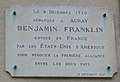 Benjamin Franklin plaque Auray.jpg 1,074 × 734; 451 KB
-
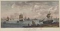
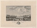
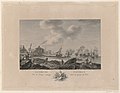
 Cassas - Le port de Lorient en 1776.jpg 740 × 440; 377 KB
-
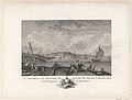
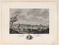
 La baie de Lorient en 1776.jpg 1,295 × 674; 270 KB
-
 La Baye de L'Orient Vu de la Citadelle de Port-Libre btv1b531856090.jpg 4,341 × 2,710; 2.89 MB
-
 La Citadelle Du Port Louis Vu de la pointe de gavres btv1b531856128.jpg 3,925 × 2,997; 2.34 MB
-
 La Citadelle et l'Entrée Du Havre Du Palais A Belle Isle btv1b53185615m.jpg 3,957 × 3,005; 2.5 MB
-
 La Rade et le Port Malo Vu des hauteurs de la Briantais btv1b53185597f.jpg 4,379 × 2,701; 2.83 MB
-
 Le Port d'Auray Vu du Côté de l'Entrée btv1b531856145.jpg 3,957 × 3,005; 2.46 MB
-
 Le Port De Camaret Vu du côté du Sud btv1b531856073.jpg 3,996 × 3,030; 2.57 MB
-
 Le Port De L'Orient Vu du Quai de la Machine à mâter btv1b53185611t.jpg 3,925 × 3,037; 2.58 MB
-
 Le Port de L'Orient Vu du Rivage de Caudran btv1b53185610c.jpg 3,925 × 3,093; 2.43 MB
-
 Le Port De Landerneau Vu du Quai de S.t Julien btv1b53185608j.jpg 3,973 × 3,061; 2.41 MB
-
 Le Port de Morlaix Vu du Quai de la Manufacture de Tabac btv1b53185600z.jpg 3,979 × 3,045; 2.43 MB
-
 Le Port De Morlaix Vue de la Grande Place, près S.t Blaine btv1b53185601d.jpg 3,979 × 3,037; 2.52 MB
-
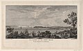
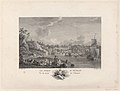
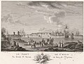
 Le port de Nantes en 1776.jpg 1,288 × 686; 265 KB
-
 Le Port De Nantes Vu de l'Hermitage btv1b53185619d.jpg 4,309 × 2,718; 2.77 MB
-
 Le Port De Nantes Vu de l'Isle Feydeau btv1b53185618z.jpg 4,005 × 3,061; 2.31 MB
-
 Le Port De Nantes Vu de l'Isle Feydeau btv1b53185647r.jpg 2,866 × 2,385; 1.77 MB
-
 Le Port De Nantes Vu du Chantier de Construction de La Fosse btv1b53185617h.jpg 3,957 × 3,077; 2.47 MB
-
 Le Port de Paimbeuf Vu du rivage contigu dans la partie de l'Est btv1b53185620s.jpg 3,989 × 3,093; 2.38 MB
-
 Le Port De Roscof Vu de Porsglase btv1b53185602v.jpg 3,979 × 3,037; 2.51 MB
-
 Le Port De S.t Malo Vu devant S.t Servan en face de l'Éperon btv1b53185598w.jpg 4,011 × 3,085; 2.36 MB
-
 Le Port De S.t Malo Vu devant S.t Servan en face de l'Éperon, 1776.jpg 2,754 × 2,077; 2.37 MB
-
 Le Port De Vannes Vu de la Sautiere à Haute Mer btv1b53185613q.jpg 3,925 × 3,013; 2.58 MB
-
 Le port du Faou en 1776 (dessin de Louis-François Cassas).jpg 768 × 474; 171 KB
-
 Porr Nantes gravure Ozanne.jpg 704 × 485; 84 KB
-
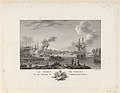
 Rade et port de Saint Malo en 1776.jpg 1,282 × 667; 272 KB
-
 Saint Servan Vu de la porte de la Marine de S.t Malo btv1b53185599b.jpg 4,011 × 3,085; 2.52 MB
.jpg)


.jpg)


