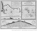
Category:1772 maps of Africa
Jump to navigation
Jump to search
Temperate regions: North America · South America · Africa · Europe · Asia · – Polar regions: – Other regions:
| ← 1770 1771 1772 1773 1774 1775 1776 1777 1778 1779 → |
Media in category "1772 maps of Africa"
The following 7 files are in this category, out of 7 total.
-
Africa - DPLA - 2882e4ae3cb297a0afe0aab038ce3ce4.jpg 1,000 × 781; 257 KB
-
Africa - DPLA - 7d0e5c1c7a62ca677703f5838ba99b89 (page 1).jpg 1,000 × 438; 134 KB
-
Africa - DPLA - 7d0e5c1c7a62ca677703f5838ba99b89 (page 2).jpg 1,000 × 431; 101 KB
-
Afrique - DPLA - c809a3e790e3a39a59ac0ee5fefbb0fc.jpg 1,000 × 892; 314 KB
-
Carte d'Afrique dressée pour l'usage du Roy - par Guillaume Delisle... - btv1b8469159g.jpg 10,750 × 8,412; 14.24 MB
-
L'Isle de Gore Schley 1772.jpg 1,300 × 969; 1.76 MB
-
Santiago-Cap Vert-1772.jpg 640 × 542; 86 KB


