Category:1770s maps of Rhode Island
Jump to navigation
Jump to search
States of the United States: Alabama · Alaska · California · Connecticut · Delaware · Florida · Georgia · Illinois · Indiana · Kentucky · Louisiana · Maine · Maryland · Massachusetts · Mississippi · Missouri · New Hampshire · New Jersey · New York · North Carolina · Ohio · Pennsylvania · Rhode Island · South Carolina · Tennessee · Vermont · Virginia
Puerto Rico
Puerto Rico
Subcategories
This category has only the following subcategory.
Media in category "1770s maps of Rhode Island"
The following 10 files are in this category, out of 10 total.
-
 1776 map Newport RhodeIsland byDesBarres BPL 12640.png 474 × 661; 320 KB
-
 A map of Connecticut and Rhode Island with Long Island Sound, etc. LOC 99466764.jpg 2,790 × 2,368; 1.36 MB
-
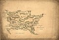
 1778 Rhode Island detail of map byKitchin BPL 14154.png 1,055 × 743; 1.56 MB
-
 Attacks upon Rhode Island, Augt. 1778. LOC gm71000685.jpg 6,299 × 4,304; 3.25 MB
-

-
 Rhode-island-map.jpg 6,230 × 4,705; 3.28 MB
-
 Coast of New England from Chatham Harbor to Narragansett Bay. LOC 77693979.jpg 12,824 × 9,072; 13.09 MB
-
 Coast of New England from Chatham Harbor to Narragansett Bay. LOC 77693979.tif 12,824 × 9,072; 332.85 MB
-
 Coast of Rhode Island and Long Island from Narragansett Bay to Peconic Bay. LOC 75693434.jpg 10,635 × 7,491; 7.6 MB
-


