Category:1770s maps of Japan
Jump to navigation
Jump to search
Countries of Asia: Armenia‡ · Azerbaijan‡ · People's Republic of China · Cyprus‡ · Egypt‡ · Georgia‡ · India · Indonesia‡ · Iran · Iraq · Japan · Pakistan · Philippines · Russia‡ · Syria · Turkey‡ · Yemen
Limited recognition: Abkhazia‡ · Taiwan · State of Palestine
‡: partly located in Asia
Limited recognition: Abkhazia‡ · Taiwan · State of Palestine
‡: partly located in Asia
Subcategories
This category has the following 2 subcategories, out of 2 total.
Media in category "1770s maps of Japan"
The following 4 files are in this category, out of 4 total.
-
 1770 Bonne Map of China, Korea, Japan and Formosa - Geographicus - China-bonne-1770.jpg 4,000 × 2,787; 3.09 MB
-
 1779 - Carte de l' Empire de la Chine avec la Tartarie Chinoise.jpg 7,144 × 5,918; 6.63 MB
-
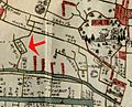 Edo-Kirishitansaka-1771.jpg 1,507 × 1,224; 2.03 MB
-
 Histoire des deux Indes-Atlas-d27-C09-Japon.png 2,328 × 1,786; 1.31 MB


