Category:1760s maps of Ecuador
Jump to navigation
Jump to search
Countries of the Americas: Argentina · The Bahamas · Brazil · Canada · Chile · Colombia · Cuba · Ecuador · Mexico · Paraguay · Peru · United States of America · Uruguay · Venezuela
Other areas: Puerto Rico
Other areas: Puerto Rico
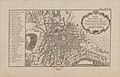
Media in category "1760s maps of Ecuador"
The following 3 files are in this category, out of 3 total.
-
 2e. feuille Suite de la province de Quito auPerou - (par J.N. Bellin) - btv1b85965093.jpg 6,144 × 4,209; 4.98 MB
-
 Carte de la Baye de Guajaquil - (par J.N. Bellin) ; Croisey sculp. - btv1b85965256.jpg 3,673 × 4,328; 2.57 MB
-
_-_btv1b85965093.jpg)
_;_Croisey_sculp._-_btv1b85965256.jpg)
_-_btv1b8596512k.jpg)