Category:1750 maps of Canada
Jump to navigation
Jump to search
| ← 1750 1751 1752 1753 1754 1755 1756 1757 1758 1759 → |
English: Maps of Canada from 1750 or related to Canada in 1750
Français : Les cartes du Canada de 1750 ou se rapportant au Canada en 1750
Media in category "1750 maps of Canada"
The following 15 files are in this category, out of 15 total.
-

-
 A plan of the harbour of Chebucto and town of Halifax. LOC 2017585994.jpg 3,784 × 3,004; 2.1 MB
-
 A plan of the harbour of Chebucto and town of Halifax. LOC 2017585994.tif 3,784 × 3,004; 32.52 MB
-

-

-
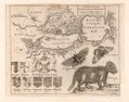
 Carte réduite de la partie septentrionale de l'isle de Terre Neuve. LOC 73694667.jpg 11,059 × 7,525; 10.47 MB
-
 Carte réduite de la partie septentrionale de l'isle de Terre Neuve. LOC 73694667.tif 11,059 × 7,525; 238.09 MB
-
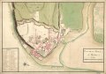
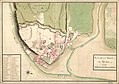 Plan de la ville de Québec. LOC 74694519.jpg 9,362 × 6,587; 7.01 MB
-
 Plan de la ville de Québec. LOC 74694519.tif 9,362 × 6,587; 176.43 MB
-

-

-
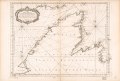
 The River St. Laurence. LOC gm72003558.jpg 18,013 × 8,246; 11.11 MB
-
 The River St. Laurence. LOC gm72003558.tif 18,013 × 8,246; 424.96 MB
-

-


