Category:1740s maps showing history
Jump to navigation
Jump to search
Media in category "1740s maps showing history"
The following 48 files are in this category, out of 48 total.
-

-
-

-

-

-

-

-

-

-

-

-

-

-
-

-

-

-

-
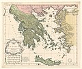
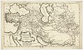
 1740 map of Ancient Greece by Matthaus Seutter.jpg 14,841 × 12,555; 41.39 MB
-
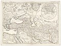
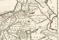 1740 map of Armenia.jpg 806 × 553; 560 KB
-

-
 L'Espagne pour l'histoire Romaine de Mr. Rollin - par le Sr d'Anville... - btv1b8490263r.jpg 4,810 × 3,910; 3.13 MB
-

-

-
-
-

-

-

-

-

-

-

-

-

-

-

-

-

-

-
 Orbis Romani Descriptio seu Divisio Per Themata.jpg 8,379 × 6,594; 13.15 MB
-
-

-
 Germano-Sarmatia in qua Populi maiores Venedi… (Vaugondy, 1740).jpg 7,056 × 5,025; 12.21 MB
-

-

-

-
 The Republic of Ragusa in the mid-18th century.jpg 2,816 × 2,112; 2.1 MB

_Rollin_-_par_le_Sr._d%27Anville,_G%C3%A9ogr(aphe)_du_Roi_-_btv1b8491292s.jpg)
_Rollin_-_par_le_Sr._d%27Anville,_G%C3%A9ogr(aphe)_du_Roi_;_grav%C3%A9e_par_P._Bourgoin_-_btv1b8468501b.jpg)


.jpg)

_Bourgoin_-_btv1b5962153d.jpg)
_Bourgoin_-_btv1b8468935h.jpg)
_Bourgoin_-_btv1b8469603t.jpg)
.jpg)
r_Rollin_-_par_le_Sr._d%27Anville,_G%C3%A9ographe_du_Roi_;_grav%C3%A9e_par_P(ierre)_Bourgoin_-_btv1b5962161z.jpg)
r_Rollin_-_par_le_Sr._d%27Anville,_G%C3%A9ographe_du_Roi_;_grav%C3%A9e_par_P(ierre)_Bourgoin_-_btv1b8468936x.jpg)
.jpg)
_d%27Anville_G%C3%A9ographe_ord(inaire)_du_Roi_;_D%C3%A9c._1740_-_btv1b53009319w.jpg)
_-_par_le_S(ieur)_d%27Anville_G%C3%A9ographe_ord(inaire)_du_Roi_;_D%C3%A9c._1740Lebas_f(ecit)_1741_-_btv1b59639255.jpg)
_-_par_le_S(ieur)_d%27Anville_G%C3%A9ographe_ord(inaire)_du_Roi_;_D%C3%A9c._1740Lebas_f(ecit)_1741_-_btv1b84689009.jpg)


.jpg)

.jpg)

.jpg)

_romaine_de_M._Rollin_-_par_le_Sr._d%27Anville,_G%C3%A9ographe_ord._du_Roi_-_btv1b84909012.jpg)
_romaine_de_M._Rollin_-_par_le_Sr._d%27Anville,_G%C3%A9ographe_ord._du_Roi_;_grav%C3%A9_par_Bourgoin_L._-_btv1b84906404.jpg)

_du_Roi_Dec._1740_-_btv1b53177720j_(1_of_2).jpg)
_du_Roi_;_grav%C3%A9e_par_Bourgoin_L._-_btv1b8468913x.jpg)
_du_Roi_;_Grav%C3%A9e_par_Bourgoin_L._-_btv1b8491492g.jpg)
_du_Roi._Mai_1742_-_btv1b59640951.jpg)
_du_Roi._Mai_1742_;_grav%C3%A9_par_P._Bourgoin_-_btv1b53171198p_(1_of_2).jpg)


.jpg)
.jpg)
.jpg)

.jpg)

.jpg)
_du_Roi_;_Grav%C3%A9e_par_P._Bourgoin_-_btv1b5964094m.jpg)
_-_par_le_S(ieur)_d%27Anville_G%C3%A9ographe_ord(inaire)_du_Roi_;_D%C3%A9c._1740Grav%C3%A9e_par_Bourgoin_L._-_btv1b84696047.jpg)
.jpg)
