Category:1730s maps of Iran
Jump to navigation
Jump to search
Subcategories
This category has the following 2 subcategories, out of 2 total.
- 1730 maps of Iran (6 F)
- 1736 maps of Iran (14 F)
Media in category "1730s maps of Iran"
The following 5 files are in this category, out of 5 total.
-
-
 Nova maris Caspii et regionis Usbeck cum provincijs adjacentibus vera delineatio.pdf 4,372 × 3,241; 2.05 MB
-
 Nova Maris Caspii Et Regionis Usbeck Cum Provincis Adjecentibus vera Delineatio.jpg 14,453 × 12,247; 36.8 MB
-
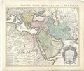
 Moll, Herman. Turkey in Asia; or Asia Minor &c. 1736 (I).jpg 1,438 × 991; 328 KB
-
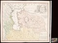
 Map - Special Collections University of Amsterdam - OTM- HB-KZL 33.05.42.tif 7,808 × 6,634; 148.2 MB
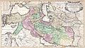
_-_Geographicus_-_RegnumPersicum-ottens-1730.jpg)

.jpg)