Category:1730 maps
Jump to navigation
Jump to search
| ← · 1730 · 1731 · 1732 · 1733 · 1734 · 1735 · 1736 · 1737 · 1738 · 1739 · → |
Deutsch: Karten mit Bezug zum Jahr 1730
English: Maps related to the year 1730
Español: Mapas relativos al año 1730
Français : Cartes concernant l’an 1730
Русский: Карты 1730 года
Subcategories
This category has the following 9 subcategories, out of 9 total.
Media in category "1730 maps"
The following 145 files are in this category, out of 145 total.
-
 "Partie de la Ville et Port de Messine" (22056520490).jpg 3,267 × 2,429; 1.7 MB
-
 "Plan de la Baye de Poyance et de celle d'Alcudia" (22056899400).jpg 3,267 × 2,429; 1.72 MB
-
 "Plan de la Baye de Ville Franche et de cele de St. Souspir" (21621941724).jpg 3,267 × 2,429; 1.93 MB
-
 "Plan de la Baye et Citadelle de Rose et de Tourrille" (22056870440).jpg 3,267 × 2,429; 1.6 MB
-
 "Plan de la Baye et rades de Cadis" (21623996323).jpg 3,267 × 2,429; 1.84 MB
-
 "Plan de la Baye et Rades de Toulon" (21622041924).jpg 3,267 × 2,429; 1.78 MB
-
 "Plan de la Baye et Rades des Isles d'Hieres" (22218695686).jpg 3,267 × 2,429; 1.66 MB
-
 "Plan de la Baye et Rades du Sofa" (21622189664).jpg 3,267 × 2,429; 1.72 MB
-
 "Plan de la Rade d'Alicant" (22244981835).jpg 3,267 × 2,429; 1.7 MB
-
 "Plan de la Rade d'Ascombrera" (21622245854).jpg 3,267 × 2,429; 1.61 MB
-
 "Plan de la Rade du Brusc et de celle de Bandol" (22056760880).jpg 3,267 × 2,429; 1.72 MB
-
 "Plan de la Rade du Gourjan et des Isles Ste. Marguerite" (22255196441).jpg 3,267 × 2,429; 1.69 MB
-
 "Plan de la Ville et Baye de Gayette" (22244588775).jpg 3,267 × 2,429; 1.66 MB
-
 "Plan de la Ville et du Mole d'Agde" (21622127984).jpg 3,267 × 2,429; 1.77 MB
-
 "Plan de la Ville et Port d'Antibe" (22056669970).jpg 3,267 × 2,429; 1.79 MB
-
 "Plan de la Ville et Port de Barcelone" (22218849506).jpg 3,267 × 2,429; 1.69 MB
-
 "Plan de la Ville et Port de Colioure" (22255330931).jpg 3,267 × 2,429; 1.71 MB
-
 "Plan de la Ville, Port et Rades de Palerme" (22231756932).jpg 3,267 × 2,429; 1.69 MB
-
 "Plan de Porto Ferraro en l'Isle de l'Elbe" (22056881418).jpg 3,267 × 2,429; 1.73 MB
-
 "Plan du Golfe de Naples" (22056833928).jpg 3,267 × 2,429; 1.73 MB
-
 "Plan du Port de Bouc, proche les Martigues" (22057102628).jpg 3,267 × 2,429; 1.96 MB
-
 "Plan du Port de Cadequié en Catalogne" (22218823116).jpg 3,267 × 2,429; 1.66 MB
-
 "Plan du Port de Cartagene" (21622262844).jpg 3,267 × 2,429; 1.71 MB
-
 "Plan du Port de Cette" (21622110624).jpg 3,267 × 2,429; 1.72 MB
-
 "Plan du Port de Trapano et des Isles Favouillane" (21623505713).jpg 3,267 × 2,429; 1.72 MB
-
 "Plan du Port et du Mole de la Ciotat" (22057954649).jpg 3,267 × 2,429; 1.66 MB
-
 "Plan du Portvendre en Roussillon" (22056846280).jpg 3,267 × 2,429; 1.7 MB
-
 (Map showing Gulf of Mexico including western portion of Caribbean area). LOC 91683704.jpg 7,043 × 9,749; 8.21 MB
-
 (Map showing Gulf of Mexico including western portion of Caribbean area). LOC 91683704.tif 7,043 × 9,749; 196.44 MB
-
 (Map showing Gulf of Mexico including western portion of Caribbean area). LOC 91683705.jpg 10,824 × 13,031; 21.35 MB
-
 (Map showing Gulf of Mexico including western portion of Caribbean area). LOC 91683705.tif 10,824 × 13,031; 403.54 MB
-
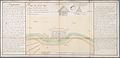
 1730 chart of the Indian Ocean.png 5,920 × 4,433; 37.94 MB
-

-
 1730 map of the Black Sea by Matthaus Seutter.jpg 6,982 × 6,034; 8.7 MB
-

-
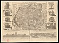
 1730 Street Map or Plan of Jerusalem - Geographicus - Jerusalem-uk-1730.jpg 2,189 × 2,771; 1.98 MB
-
 A map of Ancient Ægypt from Celarius (FL25570330 2512345).jpg 6,536 × 9,146; 77.63 MB
-
 A map of Asia as inhabited by Shem (FL27963638 2488683).jpg 9,068 × 6,694; 76.8 MB
-

-

-
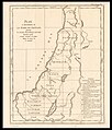
 A map of the Land of Promise.compiled out of the book of Joshua (FL37121979 3898256).jpg 2,723 × 4,433; 4.52 MB
-
 A map shewing that part of Asia inhabited by Ham and Japhet (FL27963648 2488685).jpg 6,011 × 8,510; 60.59 MB
-

-
 Africæ Descriptio (FL13728507 2510786).jpg 3,479 × 2,838; 14.28 MB
-

-
 Antoine Augustin Calmet, Carte de la Terre Promise (FL199985311 2368439).jpg 7,264 × 6,000; 23.52 MB
-
 Antoine Augustin Calmet, Carte du Paradis Terrestre (FL147392179 2368433).jpg 2,182 × 3,444; 5.48 MB
-
 Antoine Augustin Calmet, Carte du Paradise Terrestre (FL199985187 2368432).jpg 3,154 × 4,758; 21.36 MB
-
-

-
 Antoine Augustin Calmet, Description de l'ancienne Jerusalem (FL13733992 3561252).jpg 7,482 × 6,217; 72.57 MB
-

-
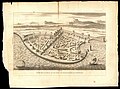
 Antoine Augustin Calmet, Plan de la Montagne des Oliviers (FL6882162 2370356).jpg 2,799 × 2,220; 4.12 MB
-
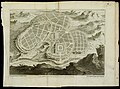
 Antoine Augustin Calmet, Plan de la ville de Nazareth (FL6880937 2372503).jpg 2,865 × 2,200; 3.58 MB
-
 Antoine Augustin Calmet, Plan du Mont Carmel (FL36012309 3911160).jpg 11,721 × 8,881; 157.35 MB
-
 Antoine Augustin Calmet, Plan du Mont Sinai, et du Mont Horeb (FL147393091 2370354).jpg 3,585 × 2,858; 10.05 MB
-
 Antoine Augustin Calmet, Plan du Mont Thabor et des environs (FL6879841 2481908).jpg 2,808 × 2,220; 3.58 MB
-
-
-

-
 Antoine Augustin Calmet, Veue de la ville et du port de Ptolémaide en Phénicie (FL32703312 2620476).jpg 13,127 × 9,780; 183.49 MB
-

-

-
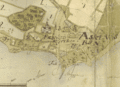
 Archiducatus Austriae inferioris 1730.jpg 3,475 × 2,969; 2.5 MB
-

-
 Arthur Bedford, A map of the countries directing to Paradise (FL46962576 3934916).jpg 3,192 × 5,155; 12.38 MB
-

-
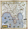 Asiae, comprehendens Indiam extra Gangem.png 4,004 × 4,198; 26.01 MB
-
 Asknäsby1730.gif 1,121 × 813; 281 KB
-
 Car'ta topographica Judeae (FL45585351 3928568).jpg 3,808 × 2,650; 1.93 MB
-
 Carte des Antilles françoises et des isles voisines (4579408086).jpg 7,921 × 9,286; 19.74 MB
-

-

-

-
 Chosŏn chido. LOC 83691553.jpg 10,830 × 13,026; 15.79 MB
-
 Chosŏn chido. LOC 83691553.tif 10,830 × 13,026; 403.61 MB
-
 Christoph Weigel the Elder, Palestine (FL33144803 3881911).jpg 7,215 × 8,627; 88.46 MB
-

-

-

-
 Cornelis Mortier, Partie Contient Les Duchés de Savoye (FL35076690 2549035).jpg 12,540 × 16,809; 319.34 MB
-
 Cruquius merwede 1730.jpg 859 × 637; 644 KB
-
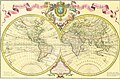 Delisle world map, 1730.jpg 3,308 × 2,166; 2.86 MB
-
 Engelbert Kaempfer, Het Koninkryk Japan verdeelt in acht en zestig Provintien (FL37251715 2469306).jpg 15,902 × 13,214; 279.04 MB
-
 Frankfurt, circa 1730.jpg 774 × 662; 201 KB
-
 Gabriel Bodenehr, Prospect von S.Petersburg und der Insul Retusari (FL39695728 2564090).jpg 7,775 × 4,966; 56.41 MB
-
 Gottfried Hensel, America cum Supplementis Poly-Glottis (FL170208269 3423107).jpg 5,468 × 5,213; 21.79 MB
-

-
 Grundriß des Ihler Flusses 1730.jpg 6,959 × 5,159; 23.62 MB
-
 Guillaume Delisle, Carte de Tartarie (FL36380622 2614786).jpg 15,062 × 12,113; 281.58 MB
-
 Henri Michelot, Nouvelle carte generalle de la Mer Mediterranée (FL16260237 3374022).jpg 11,370 × 7,439; 123.31 MB
-
 Hotel-de-Blossac---1730.svg 311 × 320; 235 KB
-

-

-
 Jean Cóvens, De haven en straat van Gibraltar (FL147555917 2470753).jpg 4,261 × 3,543; 17.08 MB
-
 Johann Friedrich Probst, Ierusalem (FL6879900 2368162).jpg 4,100 × 1,482; 3.31 MB
-
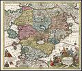
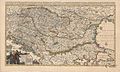 Le Royaume de Hongrie.jpg 4,942 × 2,959; 6.95 MB
-

-
-
 Map of the Holy Land Divided into the Twelve Tribes of Israel (FL36012275 3898036).jpg 5,085 × 6,208; 40.55 MB
-
 Mapa do Brasil de 1730.png 335 × 478; 317 KB
-
 Mappa geographiae naturalis.jpg 575 × 493; 142 KB
-

-
 Matthäus Seuttetre, Diversi globi terr-aquei (FL80373569 2718601).jpg 14,854 × 12,608; 220.65 MB
-

-

-

-
 Merwede map.png 4,000 × 1,774; 13.8 MB
-
 Nathaniel Crouch, Ierusalem as it now is (FL6879099 2367973).jpg 1,996 × 3,027; 2.62 MB
-
 Nicolaes Witsen, Carte generale de toutes les costes du monde (FL27971652 2719552).jpg 13,414 × 15,513; 288.55 MB
-

-

-

-
 Oriens Persia, India & c (FL27955347 2475740).jpg 10,640 × 8,393; 123.95 MB
-
 Palaestina medii aevi (FL37105393 3886797).jpg 8,980 × 6,111; 73.08 MB
-
 Palais Bourbon Hotel de Lassey Plan 1730.jpg 2,439 × 1,917; 1.92 MB
-
 Partie orientale du monde qui contiennent l'europe, l' asie, et l'afrique (FL27971625 2719555).jpg 13,396 × 15,546; 279.66 MB
-
 Pieter van der Aa, Anatolie, anciennement l'Asia Mineure (FL36009839 2715241).jpg 10,257 × 8,520; 125.4 MB
-
 Pieter van der Aa, L'Inde de ça le Gange (FL35470278 2513716).jpg 9,006 × 6,343; 72.68 MB
-
 Pieter van der Aa, Nantes (FL167448893 2370918).jpg 6,816 × 2,693; 22.04 MB
-
 Pieter van der Aa, Saint Germain en Laye (FL167448931 2370928).jpg 3,979 × 2,874; 17.51 MB
-
 Pieter van der Aa, Vienne (FL167448869 2370909).jpg 4,113 × 2,973; 15.96 MB
-
 Plan de la ville de San Domingo - Humblot Antoine - 1730.jpg 511 × 768; 132 KB
-
 Plan de la Ville et Port de Livourne" (22255081611).jpg 3,267 × 2,429; 1.72 MB
-
 Plan du Fort des Sauvages Renards.jpg 6,091 × 2,942; 6.3 MB
-
 Plano Acequia de Énova (1730) . Archivo del Reino de Valencia.jpg 7,674 × 5,216; 3.54 MB
-

-
 R. & J. Wetstein, De stadt Ierusalem 01-map (FL49973592 4073155).jpg 12,994 × 9,403; 187.02 MB
-
 R. & J. Wetstein, De stadt Ierusalem 02-verso (FL49973603 4073155).jpg 13,014 × 9,383; 175.05 MB
-
 Rade et plan de Cdix et des environs (FL147556135 2470991).jpg 5,046 × 3,648; 22.25 MB
-
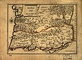 Reino do Algarve. LOC 98687125.jpg 3,329 × 2,400; 1.57 MB
-
 Reino do Algarve. LOC 98687125.tif 3,329 × 2,400; 22.86 MB
-
 Samuel Parker, A new chart of the Archipelago (FL35069294 2527506).jpg 11,152 × 13,646; 205.62 MB
-
 Accurata Utopiae Tabula.jpg 750 × 647; 243 KB
-
 T'Land Kanaans tot d'Histori van Abraham, Gen XIV. afgebakent (FL37124189 3899652).jpg 5,687 × 2,733; 8.02 MB
-
 Tabula Ducatus Carniola Vindorum marchia et Histria 1730.jpg 3,520 × 3,018; 2.07 MB
-
 Tabula serviens actibus Apostolorum (FL45585292 3927964).jpg 2,888 × 1,939; 2.33 MB
-
 Terrestrial table globe RMG D7785 3.jpg 1,280 × 862; 678 KB
-
 Terrestrial table globe RMG D7785 7.jpg 1,280 × 863; 346 KB
-

-
-
 The world according to Mercator's projection or Edw Wright's RMG F0054.tiff 5,324 × 3,337; 50.83 MB
-

-
 Verdeelinge der Wyken van de Respective Vendels der loffelyke Burgery binnen HAARLEM.jpg 1,948 × 2,522; 2.16 MB
-
 Würenlingen, Karte von 1730.jpg 4,908 × 3,464; 5.68 MB
.jpg)
.jpg)
.jpg)
.jpg)
.jpg)
.jpg)
.jpg)
.jpg)
.jpg)
.jpg)
.jpg)
.jpg)
.jpg)
.jpg)
.jpg)
.jpg)
.jpg)
.jpg)
.jpg)
.jpg)
.jpg)
.jpg)
.jpg)
.jpg)
.jpg)
.jpg)
.jpg)
._LOC_91683704.jpg)
._LOC_91683705.jpg)

_-_Geographicus_-_RhenanusSuperior-homann-1730.jpg)

.jpg)

.jpg)
.jpg)
.jpg)
.jpg)
.jpg)

.jpg)
.jpg)
.jpg)
.jpg)
.jpg)
.jpg)
.jpg)
.jpg)
.jpg)
.jpg)
.jpg)
.jpg)
.jpg)
.jpg)
.jpg)
.jpg)
.jpg)
.jpg)
.jpg)
.jpg)

.jpg)
.jpg)


.jpg)
.jpg)
.jpg)


.jpg)
.jpg)
.jpg)
.jpg)
.jpg)


.jpg)

.jpg)
.jpg)
.jpg)

.jpg)
.jpg)


.jpg)

.jpg)

.jpg)


.jpg)
.jpg)
.jpg)
.jpg)

.jpg)
.jpg)
.jpg)
.jpg)

.jpg)
.jpg)

.jpg)
.jpg)
.jpg)
.jpg)
.jpg)

.jpg)

_._Archivo_del_Reino_de_Valencia.jpg)
.jpg)
.jpg)
.jpg)
.jpg)

.jpg)

.jpg)

.jpg)


.jpg)
_and_many_remarks_not_extant_in_any_map,_according_to_the_newest_and_exact_observations_(8342714904).jpg)
.jpg)


.jpg)
.jpg)