Category:1712 maps
Jump to navigation
Jump to search
| ← · 1710 · 1711 · 1712 · 1713 · 1714 · 1715 · 1716 · 1717 · 1718 · 1719 · → |
Deutsch: Karten mit Bezug zum Jahr 1712
English: Maps related to the year 1712
Español: Mapas relativos al año 1712
Français : Cartes concernant l’an 1712
Русский: Карты 1712 года
Subcategories
This category has the following 4 subcategories, out of 4 total.
Media in category "1712 maps"
The following 35 files are in this category, out of 35 total.
-

-
 Alexanderschanze, von Prälat Johann Mayer.jpg 1,336 × 682; 1.09 MB
-

-

-
 Zollmann Hydrographia Germaniae.jpg 4,577 × 3,885; 17.37 MB
-
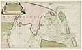 Kaart van de Zuiderzee door Nicolaas Witsen uit 1712.jpg 3,000 × 1,858; 1.15 MB
-
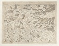 Karta över del av norra Frankrike - Skoklosters slott - 98014.tif 4,689 × 3,635; 48.78 MB
-

-
 La Chimba - Plan de la Ville de Santiago.JPG 1,171 × 827; 262 KB
-
 Les Delices de Leide, 1712 Wellcome L0000123.jpg 1,434 × 1,300; 1.02 MB
-
 Map of Ryūkyū Kingdom from Chūzan Seifu.jpg 1,280 × 1,054; 141 KB
-
 Michael Burghers, A new map of Europe (FL33132658 2521881).jpg 12,690 × 10,532; 175.46 MB
-
 Nova Helvetiae Tabula Geographica 01 11.jpg 2,913 × 2,087; 3.5 MB
-
 Nova Helvetiae Tabula Geographica 02 11.jpg 2,709 × 2,102; 3.67 MB
-
 Olfert Dapper, De Bergh Carmeli (FL165745473 2368019).jpg 6,140 × 5,307; 31.1 MB
-
 Olfert Dapper, De Bergh Thabor (FL6880569 2369753).jpg 2,798 × 2,200; 3.45 MB
-
 Olfert Dapper, De Olyf Bergh en Dal Iosaphat (FL6882276 2370190).jpg 2,799 × 2,207; 3.51 MB
-
 Olfert Dapper, De Stadt Ierusalem zoot Hedendaeghs Bevonden wordt (FL165745466 2368035).jpg 6,148 × 5,348; 27.55 MB
-
 Olfert Dapper, Jaffa, vulgo Joppen (FL6880004 2368026).jpg 2,850 × 2,181; 3.54 MB
-
 Olfert Dapper, Rama (FL6880973 2369761).jpg 2,787 × 2,250; 3.99 MB
-

-
 Philipp Clüver, Italiae antiquae delineatio (FL37479337 2590273).jpg 11,906 × 9,669; 153.13 MB
-
 Philipp Clüver, Italiae antiquae delineatio (FL37479356 2590276).jpg 12,437 × 9,746; 167.42 MB
-
 Plan de la Ville de Santiago.jpg 650 × 455; 112 KB
-
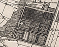
 Plan of the Hotel d'Amelot by Germain Boffrand, Paris 1712.jpg 400 × 469; 74 KB
-
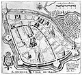
 Plan Pennier 1712 st-Jean porte église fortification.jpg 563 × 373; 69 KB
-
 R. Spofforth, A new map of Africk (FL35470152 2497110).jpg 13,167 × 10,890; 183.51 MB
-
 Sion, as depicted on a map of Cruquius 1712.jpg 1,149 × 919; 1.42 MB
-
 Sutton Nicholls, A New map of Gallia Cisalpina & Graecia Magna (FL37479375 2590657).jpg 10,488 × 12,600; 182.37 MB
-

-

-

-

-
 Ægyptus Antiqua (FL25570206 2500753).jpg 12,577 × 10,010; 184.04 MB
-
 Ægyptus Antiqua (FL25573673 3836739).jpg 13,025 × 9,778; 178.16 MB
.jpg)


.jpg)


.jpg)
.jpg)
.jpg)
.jpg)
.jpg)
.jpg)
.jpg)
.jpg)
.jpg)


.jpg)

.jpg)


.JPG)
.jpg)
.jpg)