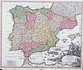
Category:1710s maps of the Iberian Peninsula
Jump to navigation
Jump to search
| 18th-century maps of the Iberian Peninsula: ← 1700s 1710s 1720s 1730s 1740s 1750s 1760s 1770s 1780s 1790s → |
Subcategories
This category has the following 2 subcategories, out of 2 total.
Media in category "1710s maps of the Iberian Peninsula"
The following 7 files are in this category, out of 7 total.
-
Spain and Portugal - Herman Moll, 1711.jpg 1,600 × 1,017; 1.4 MB
-
Carte nouvelle et curieuse du Royaume d'Espagne... - C. Inselin - btv1b53119707p.jpg 11,302 × 7,550; 14.53 MB
-
Hispania Regnum.jpg 4,832 × 3,889; 6.77 MB
-
SpainandPortugal1710.jpg 900 × 761; 233 KB


