Category:1710s maps of Australia
Jump to navigation
Jump to search
States of Australia:
Internal territories of Australia:
External territories of Australia:
Internal territories of Australia:
External territories of Australia:
Subcategories
This category has the following 2 subcategories, out of 2 total.
- 1715 maps of Australia (empty)
- 1717 maps of Australia (empty)
Media in category "1710s maps of Australia"
The following 2 files are in this category, out of 2 total.
-
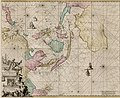 B26055982D - Orientaliora Indiarum Orientalium cum insulis adjacentibus.jpg 5,642 × 4,618; 7.14 MB
-
 New Guinea, New Britain, and New Holland &c.png 2,106 × 1,517; 4.97 MB

