Category:1701 maps
Jump to navigation
Jump to search
| ← · 1700 · 1701 · 1702 · 1703 · 1704 · 1705 · 1706 · 1707 · 1708 · 1709 · → |
Deutsch: Karten mit Bezug zum Jahr 1701
English: Maps related to the year 1701
Español: Mapas relativos al año 1701
Français : Cartes concernant l’an 1701
Русский: Карты 1701 года
Subcategories
This category has the following 6 subcategories, out of 6 total.
Media in category "1701 maps"
The following 54 files are in this category, out of 54 total.
-
 SAPUNOV(1893) -06- p075.jpg 2,327 × 1,859; 2.24 MB
-
 A system of geography with new maps. (Frontispiece) NYPL1505119.tiff 4,424 × 6,299; 79.75 MB
-

-

-
 America. NYPL1260988.tiff 3,856 × 4,773; 52.66 MB
-
 America. NYPL1505152.tiff 4,536 × 6,299; 81.77 MB
-
 Asia. NYPL1505140.tiff 4,624 × 6,299; 83.35 MB
-
 BM06215ABm.jpg 327 × 480; 58 KB
-

-
 China. NYPL1505144.tiff 4,744 × 6,299; 85.52 MB
-
 Denmark. NYPL1505133.tiff 3,111 × 1,914; 17.07 MB
-
 Ducatus Carnioliae Tabulan 1701.jpg 8,940 × 7,184; 8.75 MB
-
 Egypt and Barca etc; Abissina and Nubia etc NYPL1505150.tiff 4,648 × 6,299; 83.79 MB
-
 Eniseysk (Remezov).jpg 9,803 × 6,912; 41.47 MB
-
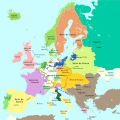 Europa 1701-es.svg 1,357 × 1,357; 1.03 MB
-
 Europa 1701.svg 1,357 × 1,357; 688 KB
-
 Friedrich Spanheim the Younger, Diocesis Orientis (FL200036693 2369060).jpg 6,558 × 4,640; 41.4 MB
-
 Friedrich Spanheim the Younger, Orbis vetus ubi Primae Ecclesiae sedes (FL200036856 2369058).jpg 5,880 × 4,617; 39.99 MB
-

-
 Germany. NYPL1505128.tiff 4,648 × 6,299; 83.79 MB
-
 Guillaume Delisle, Carte de la Turquie de l'Arabie et de la Perse (FL35866789 2632159).jpg 16,123 × 12,234; 276.71 MB
-
 Halley compass variations 1702.jpg 642 × 800; 150 KB
-
 Halley compass variations 1720.jpg 1,000 × 1,260; 319 KB
-
 Holland and the other provinces of the United Netherlands. NYPL1505127.tiff 4,640 × 6,299; 83.64 MB
-
 Hungary. NYPL1505137.tiff 4,552 × 6,299; 82.06 MB
-
 India, or the Mogul's Empire. NYPL1505146.tiff 4,816 × 2,727; 37.6 MB
-
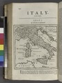 Italy. NYPL1505130.tiff 4,720 × 6,299; 85.08 MB
-
 L'Espagne dressée sur la Description qui en a été faite par Rodrigo Mendez Sylva.jpg 9,098 × 6,704; 18.34 MB
-

-

-
 Localisation Volques.jpg 400 × 300; 23 KB
-
 Mangazeya (Remezov).jpg 9,803 × 6,912; 39.48 MB
-
-

-
 Patriarchatus Hierosolymitani geographica descriptio (FL37116800 3893931).jpg 15,667 × 13,523; 256.56 MB
-
 Pelym (Remezov).jpg 9,803 × 6,912; 33.86 MB
-
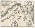
 Plan of the Spilve Battle of 9 July 1701.jpg 2,382 × 3,500; 2.64 MB
-

-
-
 Rüti - Ortsmuseum - Kloster - Grund Riss von dem Kloster Rüthj IMG 5040.jpg 1,527 × 1,555; 928 KB
-
 Savoy and Piedmont. NYPL1505129.tiff 4,664 × 6,299; 84.07 MB
-
 Scotland. NYPL1505123.tiff 4,632 × 6,299; 83.5 MB
-
 Sjøkart over kysten utenfor Sverige, fra Kristianstad til Kalmarsundet, fra 1701.png 4,565 × 2,718; 25.83 MB
-
 Spain and Portugal. NYPL1505131.tiff 4,688 × 6,299; 84.51 MB
-
 Spaldrop 1701 01.jpg 773 × 808; 387 KB
-
 Sweden and Norway System of Geography 1701.tiff 3,403 × 3,259; 31.75 MB
-
 Sweden, and Norway. NYPL1505134.tiff 4,536 × 6,299; 81.77 MB
-
 Terra Firma and the Caribbe Islands etc NYPL1505153.tiff 4,376 × 5,099; 63.85 MB
-
 The principal islands of the East Indies. NYPL1505145.tiff 4,632 × 6,299; 83.5 MB
-
 The Spanish Netherlands. NYPL1505126.tiff 4,640 × 6,299; 83.64 MB
-
 Title page, vol. 2 NYPL1505139.tiff 4,072 × 4,072; 47.44 MB
-
 Title page. NYPL1501665.tiff 3,644 × 4,501; 46.93 MB
-
 Сургут на карте 1701 года (фрагмент).jpg 776 × 820; 511 KB
-
 Сургут на карте 1701 года.jpg 2,890 × 2,010; 5.04 MB
_-06-_p075.jpg)
_(14767575995).jpg)


.jpg)


.jpg)
.jpg)
.jpg)
.jpg)


.jpg)
.jpg)
.jpg)
.jpg)

.jpg)


.jpg)
