Category:1700 maps of Brest
Jump to navigation
Jump to search
Subcategories
This category has only the following subcategory.
Media in category "1700 maps of Brest"
The following 8 files are in this category, out of 8 total.
-
 Brest (Rade de). - Carte de la rade et des environs de Brest - btv1b84409416.jpg 4,891 × 3,541; 2.57 MB
-
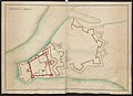
 C FI 1212 01 Plan d'une partie de Brest costé de Recouvrance.jpg 3,931 × 2,981; 768 KB
-
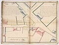
 C FI 5202 01 Plan d'une partie de la ville de Brest joignant les glacis du Château.jpg 2,426 × 1,999; 311 KB
-
 Carte de la Bade de Brest et des environs - btv1b8494537j.jpg 8,496 × 7,083; 6.59 MB
-

-
 Plan de la Ville et Citadelle de Brest - btv1b8493743n.jpg 8,223 × 6,156; 7.47 MB
-
 Plattegrond van Brest L'Echatav de Brest (titel op object), BI-B-FM-090-52.jpg 3,524 × 2,624; 1.3 MB
-
 The BL King’s Topographical Collection- "CHATEAU DE BREST.".jpg 4,000 × 2,891; 1.28 MB
._-_Carte_de_la_rade_et_des_environs_de_Brest_-_btv1b84409416.jpg)


,_BI-B-FM-090-52.jpg)
