Category:16th-century maps of the Persian Gulf
Jump to navigation
Jump to search
Media in category "16th-century maps of the Persian Gulf"
The following 7 files are in this category, out of 7 total.
-
 Cantinomap redsea persiangulf.jpg 666 × 605; 318 KB
-
 AtlasMiller.india .persian sea.jpg 1,280 × 926; 174 KB
-
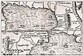 PG 1540 Basel.jpg 488 × 329; 65 KB
-
 Arabia by Jodocus Hondius 1598, reprinted 1616.tif 1,396 × 1,024; 4.09 MB
-
 Arabia WDL2920.png 1,605 × 1,024; 3.15 MB
-
 Arabia WDL2921.png 1,396 × 1,024; 2.62 MB
-
 Arabian Gulf.png 2,880 × 2,880; 6.86 MB


