Category:16th-century maps of the Eastern Mediterranean
Jump to navigation
Jump to search
English: This category collects 16th-century maps that show only the Eastern part of the Mediterranean Sea (between Italy and the Levante). This includes (from northwest to east) the Adriatic Sea, the Ionian Sea, the Libyan Sea, the Aegean Sea, the Sea of Marmara, the Levantine Sea and the Cilician Sea.
Incomplete maps (like cut-off double pages) should be categorized according to the full content of the original map, unless it is a deliberate crop.
Incomplete maps (like cut-off double pages) should be categorized according to the full content of the original map, unless it is a deliberate crop.
Subcategories
This category has the following 6 subcategories, out of 6 total.
A
C
Media in category "16th-century maps of the Eastern Mediterranean"
The following 37 files are in this category, out of 37 total.
-

-

-
 1544 Portolan chart of the Eastern Mediterranean And the Aegean Sea by Battista Agnese.tif 5,688 × 3,968; 64.6 MB
-
 João Freire. Eastern Mediterranean and Black Sea. HM 35. Portugal (?), 1546.jpg 3,951 × 4,565; 5.54 MB
-
 Europe and northern Africa. HM 29. PORTOLAN ATLAS, anonymous (Dieppe, 1547).D.jpg 2,334 × 4,216; 2.91 MB
-
 Europe and northern Africa. HM 29. PORTOLAN ATLAS, anonymous (Dieppe, 1547).J.jpg 2,334 × 1,998; 1.61 MB
-

-
 Eastern Mediterranean RMG F1407.tiff 6,434 × 5,485; 100.97 MB
-
 Eastern Mediterranean and Aegean Sea. Battista Agnese, PORTOLAN ATLAS (Italy ca. 1550).jpg 6,808 × 4,673; 8.35 MB
-
 Grichenland RMG F1733.tiff 7,395 × 4,831; 102.21 MB
-
 East Mediterranean and Black Sea RMG F1761.tiff 5,135 × 6,858; 100.75 MB
-

-

-
 Eastern Mediterranean RMG F1524.tiff 7,187 × 5,043; 103.72 MB
-
 Cyprus 1569.jpg 9,472 × 6,912; 33.32 MB
-

-
 Bodleian Library MS. Marsh 294 f 8a.jpg 788 × 1,000; 681 KB
-
 Bodleian Library MS. Marsh 294 f 9a.jpg 790 × 1,000; 713 KB
-
 Ca. 1570 map of the Eastern Mediterranean.jpg 4,001 × 2,944; 2.24 MB
-
 Fernão Vaz Dourado 1570-1 Middle East.JPG 841 × 710; 136 KB
-
 Fernão Vaz Dourado 1570-1.jpg 3,003 × 2,314; 5.58 MB
-
 East Mediterranean and Black Sea RMG F1760.tiff 6,960 × 5,076; 101.08 MB
-
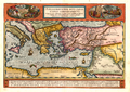
 1572 Portolan chart of the Central and Eastern Mediterranean Sea by Diogo Homem.jpg 5,805 × 4,340; 3.66 MB
-
 L'Archpielago con il stretto di Constaninopoli - Camocio Giovanni Francesco - 1574.jpg 1,555 × 2,000; 1.59 MB
-

-

-

-
 Babylonia, zwey Arabia mit Bergen, Wassern und Stetten.jpg 8,810 × 7,819; 14.25 MB
-

-
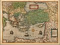
 1581 map of the Eastern Mediterranean by Heinrich Bünting.jpg 8,983 × 7,121; 12.07 MB
-
 1590 Portolan chart of the Eastern Mediterranean, the Aegean and the Black Sea by Joan Oliva.tif 3,457 × 4,941; 48.89 MB
-

-
 East Mediterranean and Black Sea RMG F1400.tiff 6,837 × 5,236; 102.42 MB
-
-
 Reisen des Paulus v Abraham Ortelius 1598.png 1,276 × 907; 2.47 MB
-
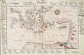
 Eastern Med portolan.jpg 432 × 616; 74 KB
-
 Stevenson 1911 atlasofportolanc00magg 0017 V Eastern Mediterranean.jpg 2,932 × 3,790; 1.09 MB

.jpg)
,_1546.jpg)
.D.jpg)
.J.jpg)
_-_bpt6k9116854h_(11_of_51).jpg)
.jpg)

.jpg)


.F.jpg)
.A.jpg)
.jpg)

.jpg)


_by_Joan_Oliva._Original_from_Library_of_Congress._Digitally_enhanced_by_rawpixel._(50623714337).jpg)