Category:16th-century maps of Western Europe
Jump to navigation
Jump to search
Media in category "16th-century maps of Western Europe"
The following 2 files are in this category, out of 2 total.
-
 Fotothek df tg 0005103 Geographie ^ Karte.jpg 800 × 655; 280 KB
-
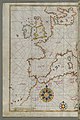 Piri Reis - Map of Western Europe and North Africa - Walters W65864A - Full Page.jpg 1,199 × 1,800; 2.88 MB

