Category:16th-century maps of Sicily
Jump to navigation
Jump to search
Subcategories
This category has the following 4 subcategories, out of 4 total.
Media in category "16th-century maps of Sicily"
The following 15 files are in this category, out of 15 total.
-
 Sicily by Piri Reis.jpg 600 × 826; 338 KB
-
 Tabula Europae VII.jpg 556 × 450; 65 KB
-
 Print, book-illustration, map (BM 1982,U.2467).jpg 1,728 × 2,500; 1.3 MB
-
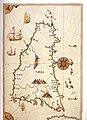
 Map of Sicily according to contemporary geographers - Bordone Benedetto - 1547.jpg 1,500 × 1,410; 856 KB
-
 Map of Sicily according to Ptolemy - Bordone Benedetto - 1547.jpg 800 × 667; 290 KB
-
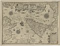
 Corsica to Corfu and Tripoli RMG F1411.tiff 6,473 × 5,433; 100.62 MB
-
 Atlas factice des possessions de Venise et de l'Archipel - btv1b55010184g (075 of 127).jpg 4,322 × 3,367; 2.33 MB
-
 Atlas Ortelius KB PPN369376781-071av-071br.jpg 3,000 × 2,194; 4.46 MB
-

-

-

-
-
-
 Isola de Sicilia - btv1b8494738n.jpg 7,584 × 6,092; 7.07 MB
-


.jpg)


.jpg)

.jpg)
.jpg)
.jpg)
_44.jpg)


,_optima,_et_Mediterranei_maris_maxima..._RRA_3%3D_72._Pi%C3%A8ce_41.jpg)