Category:16th-century maps of Moravia
Jump to navigation
Jump to search
Subcategories
This category has only the following subcategory.
M
Media in category "16th-century maps of Moravia"
The following 7 files are in this category, out of 7 total.
-
 Mapa Slezska 1561.jpg 2,388 × 1,996; 1.17 MB
-
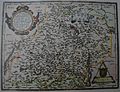
 Fabriciova mapa Moravy.jpg 9,764 × 9,385; 16.23 MB
-
 Mapa Moravy 1569.jpg 2,404 × 1,904; 688 KB
-
 Atlas Ortelius KB PPN369376781-050av-050br.jpg 3,000 × 2,194; 4.52 MB
-
 Orteliova kopie první mapy Moravy z roku 1573.jpg 3,345 × 2,569; 2.8 MB
-
 Map of Moravia, 1575.jpg 1,673 × 1,481; 1.19 MB
-
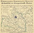
 Moraviae, Quae Olim Marcomannorum Sedes Corographia.jpg 12,367 × 9,545; 25.24 MB


