Category:16th-century maps of Frankfurt am Main
Jump to navigation
Jump to search
Subcategories
This category has the following 2 subcategories, out of 2 total.
1
- Fabers Belagerungsplan (1 P, 70 F)
Media in category "16th-century maps of Frankfurt am Main"
The following 8 files are in this category, out of 8 total.
-
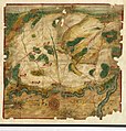
 Frankfurt Münster 1550.jpg 2,805 × 2,034; 1.37 MB
-
 Gebiet um Frankfurt mit Landwehr, Fechenheim und Bornheim.jpg 3,000 × 1,976; 1.3 MB
-
 Karte der Dörfer Nied und Griesheim.jpg 3,000 × 2,229; 1.8 MB
-
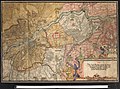
 Karte über den Bornheimer Berg und Frankfurt.jpg 3,000 × 2,285; 1.75 MB
-
 Karte des Gebietes zwischen Rhein und Main.jpg 9,414 × 6,424; 59.83 MB
-
 Karte des Gebiets zwischen Main und Nidda.jpg 4,112 × 4,960; 25.3 MB
-
 Karte mit der Umgebung der beiden Dorfelden.jpg 2,863 × 3,000; 1.37 MB
-


