Category:16th-century maps of Andalusia
Jump to navigation
Jump to search
Autonomous communities of Spain: Andalusia · Canary Islands · Autonomous cities:
Subcategories
This category has the following 24 subcategories, out of 24 total.
M
Media in category "16th-century maps of Andalusia"
The following 19 files are in this category, out of 19 total.
-
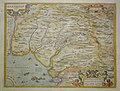
 Andalusia (1588).jpg 800 × 581; 152 KB
-

-
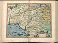
 Portugalliae Regnum," 1597 a closer view.jpg 800 × 600; 189 KB
-
 Portugalliae Regnum," 1597.jpg 800 × 600; 182 KB
-
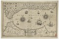
 Andalucia-Hispalensis.jpg 2,367 × 1,800; 665 KB
-
 Atlas Ortelius KB PPN369376781-014av-014br.jpg 3,000 × 2,194; 4.66 MB
-

-

-

-
 Granada by Piri Reis.jpg 813 × 539; 560 KB
-
 Grenada (1581).jpg 800 × 689; 148 KB
-
-
 Kitab-i Bahriye Kingdom of Granada.png 5,742 × 3,754; 35.12 MB
-
-

-

-
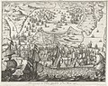
 Zeeslag voor Cadiz, 1596, RP-P-OB-80.177.jpg 6,018 × 4,430; 8.18 MB
-
 Zeeslag voor Cadiz, 1596, RP-P-OB-80.181.jpg 5,782 × 4,150; 7 MB
-
 Zeeslag voor Cadiz, 1596, RP-P-OB-80.184.jpg 5,292 × 4,336; 5.18 MB
.jpg)
es_Aurigarius_Inventor_;_Ioannes_%C3%A0_Doetecum_fecit_-_btv1b53194504b_(2_of_3).jpg)


_Serie_4_Franse,_Duitse_en_Engelse_Gebeurtenissen,_1576-,_RP-P-OB-78.785-300.jpg)
_Serie_4_Franse,_Duitse_en_Engelse_Gebeurtenissen,_1576-1610_(serietitel),_RP-P-OB-78.784-82.jpg)
_door_de_Hollanders_en_Engelsen_ingenomen,_9_Juni_1596_Cales_Males_Durch_die_Englische_undf_Holender_eingenomen_alles_verbrant_und_mit_groser_beut_darvon_komen_den_9._juni_Ao._1596_(titel_op_object),_RP-P-1910-2102.jpg)

.jpg)


,_RP-P-OB-80.182.jpg)
,_RP-P-2018-1761.jpg)
,_RP-P-OB-80.183.jpg)


