Category:1680s maps of the Iberian Peninsula
Jump to navigation
Jump to search
| 17th-century maps of the Iberian Peninsula: ← 1600s 1610s 1620s 1630s 1640s 1650s 1660s 1670s 1680s 1690s → |
Subcategories
This category has the following 2 subcategories, out of 2 total.
Media in category "1680s maps of the Iberian Peninsula"
The following 13 files are in this category, out of 13 total.
-
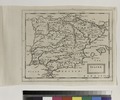
 Map of ancient Spain, 1683.jpg 698 × 993; 251 KB
-

-

-
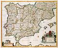
 Accuratissima totius regni Hispaniae tabula - CBT 5880393.jpg 7,096 × 4,278; 10.01 MB
-
 Atlas Van der Hagen-KW1049B12 002-HISPANIAE ET PORTUGALIAE REGNA.jpeg 5,500 × 4,563; 4.31 MB
-

-
 Map - Special Collections University of Amsterdam - OTM- HB-KZL 32.21.56.tif 7,384 × 6,167; 130.28 MB
-

-
 Spaine (NYPL b14428893-1503415).jpg 6,299 × 5,248; 7.53 MB
-
 Spaine. NYPL1503415.tiff 6,299 × 5,248; 94.6 MB
-
 Cartes generales de toutes les parties du monde 1681 (127474803).jpg 13,992 × 9,392; 16.23 MB
-
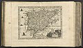 Philippi Cluverii introductio in universam geographiam 1683 (102475069).jpg 6,092 × 3,563; 4.07 MB
-
 Philippi Cluverii introductio in universam geographiam 1683 (84936386).jpg 6,473 × 4,932; 5.62 MB


.jpg)


.jpg)

.jpg)
.jpg)
.jpg)
.jpg)