Category:1680s maps of South Carolina
Jump to navigation
Jump to search
States of the United States: Delaware · Florida · Illinois · Louisiana · Maryland · New Jersey · New Mexico · New York · Pennsylvania · South Carolina · Virginia
Media in category "1680s maps of South Carolina"
The following 2 files are in this category, out of 2 total.
-
 Charleston Harbor in 1682.jpg 2,880 × 1,800; 1,002 KB
-
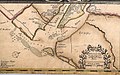
 Gascoyne, Country of Carolina.jpg 1,784 × 1,471; 1.08 MB

