Category:1680s maps of Ontario
Jump to navigation
Jump to search
Media in category "1680s maps of Ontario"
The following 7 files are in this category, out of 7 total.
-
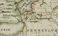 Darlington map of the Niagra region 1680.png 782 × 497; 956 KB
-
 Vincenzo Coronelli Partie occidentale du Canada 1688.PNG 1,906 × 1,418; 6.25 MB
-
 Western New France, 1688.jpg 953 × 709; 186 KB
-
 Fond de la baie d'Hudson avec les fort anglais pris par les Français en 1686.jpg 4,568 × 4,449; 5.38 MB
-
 Fort Frontenac 1682.jpg 823 × 1,151; 274 KB
-
 Fort frontenac.jpg 1,312 × 1,569; 1.15 MB
-
 Lac-Taronto.jpg 600 × 397; 87 KB


