Category:1664 maps of Africa
Jump to navigation
Jump to search
Temperate regions: North America · South America · Africa · Europe · Asia · – Polar regions: – Other regions:
| ← 1660 1661 1662 1663 1664 1665 1666 1667 1668 1669 → |
Media in category "1664 maps of Africa"
The following 7 files are in this category, out of 7 total.
-
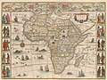 Africae nova descriptio - DPLA - 3c23b9bded0a0d36d7ecbe30eddecaf3.jpg 1,000 × 754; 293 KB
-
 Atlas de la mer Méditerranée (Reprod. numérique) - par Brémond - btv1b53028104r (06 of 10).jpg 9,720 × 6,998; 10.95 MB
-
 Duval L'Afrique 1664 UTA.jpg 6,474 × 4,990; 13.74 MB
-
-
 Gigeri in Africa preso e poi abbandonato da Francesi anno 1662 LCCN2016645787.jpg 1,536 × 1,247; 322 KB
-
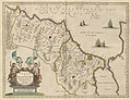
 Nova Barbariae descriptio - btv1b531712105 (1 of 2).jpg 6,361 × 4,365; 5.44 MB
-
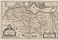
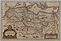 Nova Barbariae descriptio - btv1b85953360 (1 of 2).jpg 8,384 × 5,756; 8.77 MB

_-_par_Br%C3%A9mond_-_btv1b53028104r_(06_of_10).jpg)


.jpg)
.jpg)