Category:1660s maps of Pernambuco
Jump to navigation
Jump to search
Media in category "1660s maps of Pernambuco"
The following 5 files are in this category, out of 5 total.
-
 Johannes Vingboons - Plattegrond van Olinda (1665).jpg 1,280 × 905; 313 KB
-
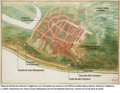 MapaOlindaConventoSãoFrancisco.png 1,024 × 794; 1.55 MB
-
 AMH-6784-NA Map of Pernambuco.jpg 2,400 × 1,869; 712 KB
-

-
 Praefecturae de Paraiba, et Rio Grande (watercolored).jpg 9,203 × 7,291; 43.99 MB
.jpg)


.jpg)