Category:1660s maps of Norway
Jump to navigation
Jump to search
Subcategories
This category has the following 5 subcategories, out of 5 total.
- 1660 maps of Norway (4 F)
- 1661 maps of Norway (1 F)
- 1662 maps of Norway (4 F)
- 1666 maps of Norway (3 F)
- 1668 maps of Norway (3 F)
Media in category "1660s maps of Norway"
The following 4 files are in this category, out of 4 total.
-
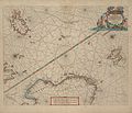 1663 map Pieter Goos northsea norwegian sea.jpg 6,950 × 5,989; 4.1 MB
-
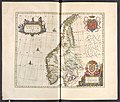
 Suecia 1-006 ; Nova et accvrata orbis arctoi tabvla geographica.jpg 3,480 × 2,405; 3.84 MB
-
-
 Sjøkart over Vestlandet, fra Bergen og nordover, fra ukjent årstall.png 3,892 × 3,177; 25.27 MB


.1.(11).jpg)
