Category:1660s maps of London
Jump to navigation
Jump to search
Subcategories
This category has the following 2 subcategories, out of 2 total.
Media in category "1660s maps of London"
The following 26 files are in this category, out of 26 total.
-
 Port of London in 1661.jpg 2,880 × 1,800; 1.18 MB
-

-

-
 A map or groundplott of the citty of London, with the suburbes thereof (BM Q,6.57 1).jpg 2,500 × 1,847; 1.37 MB
-
 A map or groundplott of the citty of London, with the suburbes thereof (BM Q,6.57).jpg 2,500 × 1,743; 1.7 MB
-

-
 Platte Grondt der Verbrande Stadt London (BM 1880,1113.1172).jpg 2,500 × 2,000; 1.31 MB
-
 Platte Grondt der Verbrande Stadt London (BM 1885,1114.151).jpg 2,500 × 2,155; 1.38 MB
-
 Platte grondt der verbrannte stadt London (BM 1872,0113.593 1).jpg 2,500 × 1,455; 1.01 MB
-

-

-

-

-

-
-

-
 287 of '(London ... With ... illustrations.)' (11227439174).jpg 2,400 × 1,473; 1.35 MB
-
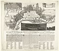
 A Map of Both Citties London and Westminster, Before the Fire. (BM 1888,0612.57).jpg 2,500 × 1,313; 1.21 MB
-

-
 338 of 'London ... With ... illustrations' (11218059565).jpg 2,464 × 1,482; 1.47 MB
-

-
 London (1892) (14791006593).jpg 3,104 × 1,884; 1.15 MB
-
 Map of London and Westminster before the Fire of London. Wellcome M0012069.jpg 4,728 × 2,262; 2.44 MB
-
 Platte grondt der verbrannte stadt London (BM 1872,0113.593).jpg 2,500 × 1,403; 989 KB
-

-
 Whitehall from the river circ 1667 (14597913498).jpg 3,360 × 2,308; 1.04 MB

.jpg)
.jpg)
.jpg)
.jpg)
.jpg)
.jpg)
.jpg)
.jpg)
,_RP-P-OB-82.347.jpg)
_Afbeelding_van_de_Stadt_London._Aenwijzende_hoe_verre_de_zelve_verbrandt_is,_en_wat_plaetzen_noch_overgebleven_zijn_Rep,_RP-P-OB-82.346.jpg)
_A_true_Pourtraict_with_a_Brief_Description_of_that_deplorable_Fire_of_London,_B,_RP-P-OB-82.343.jpg)
,_RP-P-OB-82.342.jpg)
,_RP-P-OB-82.344.jpg)
_Afbeelding_van_de_Stadt_London._Aenwijzende_hoe_verre_de_zelve_verbrandt_is,_en_wat_plaetzen_noch_overgebleve,_RP-P-OB-82.345.jpg)
_Afbeeldingh_van_de_Stadt_London,_Aenwijsende_hoe_verre_de_selve_verbrandt_is,_en_wat_plaetsen_noch_overgeblev,_RP-P-OB-82.018.jpg)
%27_(11227439174).jpg)
.jpg)
.jpg)
.jpg)

_(14791006593).jpg)

.jpg)
.jpg)
.jpg)