Category:1660s maps of Egypt
Jump to navigation
Jump to search
Countries of Asia: Azerbaijan‡ · People's Republic of China · Egypt‡ · India · Indonesia‡ · Iran · Japan · Pakistan · Russia‡ · Syria · Turkey‡
Limited recognition: Taiwan · State of Palestine
‡: partly located in Asia
Limited recognition: Taiwan · State of Palestine
‡: partly located in Asia
Media in category "1660s maps of Egypt"
The following 9 files are in this category, out of 9 total.
-
 Arabiae Desertae Pars - Patami Arabes - (Thevenot, 1660) - btv1b59001126 (1 of 2).jpg 10,408 × 5,704; 6.89 MB
-
 Thévenot, Melchisédech. Iter a Gaza ad montem Sinaï ex Brittembachio (1659-1661).jpg 1,332 × 1,758; 482 KB
-

-

-

-
 Aegyptvs et Cyrene - DPLA - 86669494727a6d82393a2f7ab7a60121.jpg 1,000 × 626; 214 KB
-
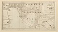
 Egyptvs Antiqua Divisa in Nomos - DPLA - 36d19271fd983ada42bbcfd321fe5ba8.jpg 1,000 × 779; 277 KB
-
 Nieuwe Kaert van Egipten. R 2= 22. Pièce 11.jpg 6,984 × 4,768; 6.15 MB
-
 Oude kaart van Egypte (17e eeuw)- Old map of Egypt (17th century).jpg 1,749 × 1,193; 2.3 MB
_-_btv1b59001126_(1_of_2).jpg)
.jpg)
.10.(26).jpg)


-_Old_map_of_Egypt_(17th_century).jpg)
.jpg)