Category:1652 maps
Jump to navigation
Jump to search
| ← · 1650 · 1651 · 1652 · 1653 · 1654 · 1655 · 1656 · 1657 · 1658 · 1659 · → |
Deutsch: Karten mit Bezug zum Jahr 1652
English: Maps related to the year 1652
Español: Mapas relativos al año 1652
Français : Cartes concernant l’an 1652
Русский: Карты 1652 года
Subcategories
This category has the following 4 subcategories, out of 4 total.
Media in category "1652 maps"
The following 37 files are in this category, out of 37 total.
-

-
 America Septentrionalis LOC 2006629174.jpg 5,628 × 4,785; 4.68 MB
-
 America Septentrionalis LOC 2006629174.tif 5,628 × 4,785; 77.05 MB
-
 Americae descriptio nova - Will. Trevethen, sculp. NYPL434530.tiff 4,544 × 5,195; 67.54 MB
-
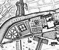 Berlin Memhardt Plan 1652 Lustgarten.jpg 800 × 684; 210 KB
-
 Blaau mtricht02.jpg 932 × 852; 246 KB
-
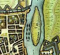
 Bird's-Eye View of Zeelandia, c. 1652.jpg 1,000 × 618; 307 KB
-
 Caspar Schmalkalden-Formosa.jpg 1,600 × 974; 1,003 KB
-
 CasparSchmalkalden TaiwanMap.jpg 956 × 604; 174 KB
-
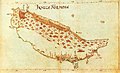
 Map of Formosa, c. 1652.jpg 1,000 × 600; 259 KB
-
 約1648年的台灣老地圖.jpg 895 × 596; 336 KB
-

-
 Claes Visscher's World Map.jpg 1,722 × 1,400; 4.71 MB
-
 Doncker sea atlas world map.jpg 760 × 575; 200 KB
-
 Eastern Mediterranean, 1652.jpg 4,176 × 3,260; 3.21 MB
-
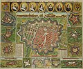 Groningen (afbeeldinge der stadt Groningen met omliggende fortressen) - Haubois, 1652.jpg 3,000 × 2,493; 2.11 MB
-
 Helgoland 1652.jpg 945 × 696; 519 KB
-
 Henry Seile, Africæ Descriptio Nova (FL13728525 2511074).jpg 7,048 × 5,536; 62.92 MB
-
 Henry Seile, Europæ Descriptio Nova (FL33133698 2525158).jpg 10,350 × 7,997; 118.97 MB
-
 Het Canaal tusschen Engeland en Vranciick (FL37808100 3033641).jpg 12,549 × 7,939; 128.27 MB
-
 Jan Janssonius - Japan.jpg 6,726 × 5,561; 8.04 MB
-

-
 Jan Janssonius, Turcicum imprium (FL36011237 2821574).jpg 14,054 × 11,944; 232 MB
-
 John Goddard, Asiae descriptio nova (FL27955394 2480838).jpg 10,973 × 8,443; 123.68 MB
-

-

-
 Mogol map 1652.jpg 1,852 × 1,560; 1.45 MB
-
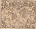
 Nova Totius Terrarum Orbis geographica ac hydrographica tabula 1652.jpg 14,145 × 11,890; 70.95 MB
-
 Orbis terrarum typus de integro multis in locis emendatus LOC 2017585799.jpg 6,765 × 5,419; 7.62 MB
-
 Orbis terrarum typus de integro multis in locis emendatus LOC 2017585799.tif 6,765 × 5,419; 104.88 MB
-
-
 Philippe de La Rué, Asia Minor (FL36010826 2716581).jpg 13,763 × 10,170; 195.86 MB
-
 Royaume de Navarre divisée en six merindades.png 506 × 673; 702 KB
-
 Staten Island (Jan Janssonius 1652).jpeg 2,765 × 2,719; 1.5 MB
-
 AMH-6416-NA Map of Zeelandia and environs, Formosa.jpg 11,511 × 10,343; 13.85 MB
-
 Terra Sancta (FL48495454 4066380).jpg 3,885 × 2,473; 11 MB
-
 Terra Sancta (FL48495457 4066383).jpg 3,553 × 2,269; 6.54 MB
_-_Geographicus_-_Paris-gomboust-1900.jpg)


_-_Haubois,_1652.jpg)

.jpg)
.jpg)
.jpg)

.jpg)
.jpg)
.jpg)


_-_Geographicus_-_ParisSm-gomboust-1900.jpg)
.jpg)

.jpeg)

.jpg)
.jpg)