Category:1630s maps of Africa
Jump to navigation
Jump to search
Temperate regions: North America · South America · Africa · Europe · Asia · – Polar regions: – Other regions:
Subcategories
This category has the following 15 subcategories, out of 15 total.
- 1630 maps of Africa (3 F)
- 1631 maps of Africa (8 F)
- 1632 maps of Africa (2 F)
- 1633 maps of Africa (4 F)
- 1634 maps of Africa (empty)
- 1635 maps of Africa (11 F)
- 1636 maps of Africa (3 F)
- 1638 maps of Africa (4 F)
- 1639 maps of Africa (2 F)
A
- 1630s maps of Algeria (empty)
E
- 1630s maps of Egypt (empty)
- 1630s maps of Ethiopia (7 F)
L
- 1630s maps of Libya (1 F)
M
- 1630s maps of Morocco (2 F)
T
- 1630s maps of Tunisia (1 F)
Media in category "1630s maps of Africa"
The following 3 files are in this category, out of 3 total.
-
 Bodleian Libraries, Gulf of Guinea 8.jpg 1,000 × 675; 91 KB
-
 Maure Alger et Espagne.jpg 1,340 × 976; 331 KB
-
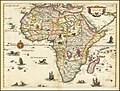 Nova descriptio Africae.jpg 9,026 × 6,868; 12.83 MB


