Category:1621 maps
Jump to navigation
Jump to search
| ← · 1620 · 1621 · 1622 · 1623 · 1624 · 1625 · 1626 · 1627 · 1628 · 1629 · → |
Deutsch: Karten mit Bezug zum Jahr 1621
English: Maps related to the year 1621
Español: Mapas relativos al año 1621
Français : Cartes concernant l’an 1621
Русский: Карты 1621 года
Subcategories
This category has the following 4 subcategories, out of 4 total.
Media in category "1621 maps"
The following 24 files are in this category, out of 24 total.
-
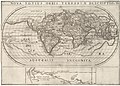 AMH-6924-KB Map of the world and chart of New Guinea.jpg 2,400 × 1,712; 961 KB
-
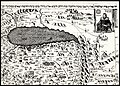
 Armenian map of geographical zones, 1621.jpeg 1,004 × 785; 356 KB
-
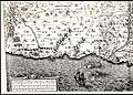
 Courbes-Relacion del viaje.jpg 2,174 × 2,505; 1.17 MB
-
 George Sandys, Ierusalem (FL6881062 2368170) cropped.jpg 2,093 × 2,587; 1.82 MB
-
 George Sandys, Ierusalem (FL6881062 2368170).jpg 2,280 × 2,719; 2.57 MB
-
 George Sandys, Mount Olivet (FL6878729 2370191).jpg 2,259 × 2,595; 2.88 MB
-
 George Sandys, The way betweene Ierusalem and Bethlem (FL6878990 2370203).jpg 2,248 × 2,495; 2.77 MB
-
 Guillaume Postel CHASDIA seu Australis terra.jpg 1,807 × 1,728; 422 KB
-

-

-

-
-

-
-

-

-

-
 Jan Janssonius, Westmorland Castria Cestria et cetera (FL35475074 2582146).jpg 5,124 × 4,011; 27.78 MB
-
 Joris van Spilbergen in the bay of Valparaiso 1615.png 728 × 518; 307 KB
-
 Map of the Strait of Magellan LCCN2003663630.jpg 1,333 × 1,536; 484 KB
-
 Map of the Strait of Magellan LCCN2003663630.tif 1,333 × 1,536; 1.96 MB
-
 Tartariae Imperium (FL36380711 2622656).jpg 5,124 × 7,234; 52.05 MB
-
 Terrestrial table globe RMG D7256 1.jpg 977 × 1,280; 374 KB
-
 Terrestrial table globe RMG D7256 3.jpg 1,000 × 1,280; 596 KB


_cropped.jpg)
.jpg)
.jpg)
.jpg)

.jpg)
.jpg)
.jpg)
.jpg)
.jpg)
.jpg)
.jpg)
.jpg)
.jpg)


.jpg)


.jpg)