Category:1610 maps
Jump to navigation
Jump to search
| ← · 1610 · 1611 · 1612 · 1613 · 1614 · 1615 · 1616 · 1617 · 1618 · 1619 · → |
Deutsch: Karten mit Bezug zum Jahr 1610
English: Maps related to the year 1610
Español: Mapas relativos al año 1610
Français : Cartes concernant l’an 1610
Русский: Карты 1610 года
Subcategories
This category has the following 4 subcategories, out of 4 total.
Media in category "1610 maps"
The following 20 files are in this category, out of 20 total.
-

-
 Carmarthen.1610.Speed.map.jpg 1,800 × 1,097; 188 KB
-
 Description du pays messin et ses confins 1610.jpg 1,151 × 1,024; 541 KB
-
 Die Statt Jerusalem (FL6879792 2369665).jpg 2,500 × 1,645; 2.13 MB
-
 Eastern Mediterranean (FL36012259 3897595).jpg 5,208 × 4,529; 33.53 MB
-
 Engraved map of Chichester from John Speed's 1610 map of Sussex.jpg 1,084 × 809; 751 KB
-
-

-
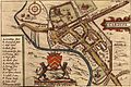
 John Speed's map of Cardiff 1610.jpg 448 × 392; 86 KB
-
 John Speed's map of Cardiff, Wales (full).jpg 640 × 429; 240 KB
-
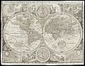 Map of the world. Wellcome L0051173.jpg 6,557 × 5,060; 12.44 MB
-
 Natolia Sive Asia Minor (FL36010666 2716056).jpg 12,984 × 10,618; 207.21 MB
-
 Nova Hispaniae Descriptio, por Jodocus Hondius.jpg 1,721 × 1,266; 3.06 MB
-
 Pays messin-Luxembourg-1610.jpg 1,904 × 2,781; 1.56 MB
-
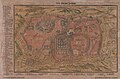
 Râisen der kinder Israel aus Egypten ins land Canaan (FL6882847 2561632).jpg 4,004 × 2,884; 17.49 MB
-
 Tabula XXXXII mansionum Populi Israelitici in deserto (FL36566248 3913620).jpg 10,952 × 8,485; 123.56 MB
-

-
 The division of the land of Canaan for the twelve tribes of Israel (FL37121836 3897769).jpg 2,405 × 3,859; 4.39 MB
-

-
 Turcicum Imperium (FL13729633 2516034).jpg 4,663 × 4,061; 24.58 MB
.jpg)


.jpg)
.jpg)

.jpg)
.jpg)

.jpg)

.jpg)


.jpg)
.jpg)
.jpg)
.jpg)
.jpg)
.jpg)