Category:1600s maps of Iran
Jump to navigation
Jump to search
Subcategories
This category has only the following subcategory.
M
Media in category "1600s maps of Iran"
The following 10 files are in this category, out of 10 total.
-
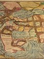 Map of ancient Persia (1600) a closer view.jpg 800 × 1,067; 208 KB
-
 Map of ancient Persia (1600).jpg 800 × 1,067; 170 KB
-
 Johann Bussemacher, Persiæ regnum sive Sophorv Imperium (FL35061580 2516865).jpg 8,073 × 6,395; 65.23 MB
-
 Abraham Ortelius and Jan van Keerbergen. Persia. 1603.jpg 10,621 × 7,673; 5.74 MB
-
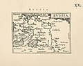 Ortelius.Russia.jpg 1,600 × 1,267; 401 KB
-
 Persia, from 'Geographisch Handtbuch (north east).jpg 800 × 600; 155 KB
-
 Persia, from 'Geographisch Handtbuch (north west).jpg 800 × 600; 167 KB
-
 Persia, from 'Geographisch Handtbuch (south east).jpg 800 × 600; 169 KB
-
 Persia, from 'Geographisch Handtbuch (south west).jpg 800 × 600; 171 KB
-
 Persia, from 'Geographisch Handtbuch.jpg 800 × 600; 182 KB
_a_closer_view.jpg)
.jpg)
.jpg)


.jpg)
.jpg)
.jpg)
.jpg)
