Category:1580s maps of Spain
Jump to navigation
Jump to search
Subcategories
This category has the following 2 subcategories, out of 2 total.
- 1586 maps of Spain (1 F)
1
Media in category "1580s maps of Spain"
The following 12 files are in this category, out of 12 total.
-
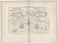
 (La Coruña. El Ferrol, Spain) LOC 2004629171.jpg 6,295 × 4,950; 4.49 MB
-
 (La Coruña. El Ferrol, Spain) LOC 2004629171.tif 6,295 × 4,950; 89.15 MB
-
-
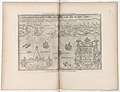
 Carpetaniae partis descr. - (Georgius Hoefnaglius) - btv1b53057072z (1 of 2).jpg 3,136 × 2,448; 1.27 MB
-

-
 1586 Biscaien Waghenaer.jpg 1,759 × 1,131; 1.66 MB
-
 Spain (1588).jpg 799 × 569; 131 KB
-

-
-
 La Coruña. El Ferrol, Spain LOC 2004629169.jpg 8,520 × 6,207; 9.39 MB
-
 La Coruña. El Ferrol, Spain LOC 2004629169.tif 8,520 × 6,207; 151.3 MB
-
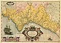 Mapa regne valencia ortelius.jpg 3,500 × 2,466; 3.15 MB
_LOC_2004629171.jpg)
es_Aurigarius_Inventor_;_Ioannes_%C3%A0_Doetecu(m)_F(ecit)_-_btv1b53194471h_(2_of_3).jpg)
_-_btv1b53057072z_(1_of_2).jpg)
_perlustrabat_et_sua_manu_depingebat_Georgius_Hoefnaglius..._-_btv1b8442276m_(1_of_2).jpg)

.jpg)
.jpg)
.jpg)

