Category:1570s maps of Greece
Jump to navigation
Jump to search
Countries of Europe: Albania · Armenia‡ · Austria · Azerbaijan‡ · Belgium · Bosnia and Herzegovina · Croatia · Cyprus‡ · France‡ · Georgia‡ · Germany · Greece · Hungary · Italy · Latvia · Lithuania · Netherlands‡ · Poland · Portugal‡ · Romania · Russia‡ · Slovakia · Slovenia · Spain‡ · Turkey‡ · Ukraine
Limited recognition: Abkhazia‡
‡: partly located in Europe
Limited recognition: Abkhazia‡
‡: partly located in Europe
Media in category "1570s maps of Greece"
The following 15 files are in this category, out of 15 total.
-
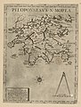 Peloponnesus N Morea - Per Claudio Ducheto - btv1b53033711p.jpg 3,156 × 4,160; 2.35 MB
-
 Peloponnesus N Morea - Per Claudio Ducheto - btv1b550000088.jpg 4,335 × 6,209; 2.49 MB
-
 Peloponnesus N Morea - Per Claudio Ducheto - btv1b55000280r.jpg 4,264 × 6,065; 2.38 MB
-
 Peloponnesus N Morea - Per Claudio Ducheto - btv1b55004588v.jpg 4,427 × 6,076; 2.56 MB
-
 Peloponnesus N Morea - Per Claudio Ducheto - btv1b55004894m.jpg 3,190 × 4,271; 1.7 MB
-
 Graetia Nuova Tavola (Greece) southeast.jpg 800 × 600; 150 KB
-
 Atlas factice des possessions de Venise et de l'Archipel - btv1b55010184g (079 of 127).jpg 4,325 × 3,372; 2.19 MB
-
 Atlas Ortelius KB PPN369376781-075av-075br.jpg 3,000 × 2,194; 4.72 MB
-
 L'Archpielago con il stretto di Constaninopoli - Camocio Giovanni Francesco - 1574.jpg 1,555 × 2,000; 1.59 MB
-

-
 Graetia Nuova Tavola (Greece) northeast.jpg 800 × 600; 148 KB
-

-

-

-


_southeast.jpg)
.jpg)


.jpg)
_northeast.jpg)
_-_(Fran%C3%A7ois_de_Belleforest)_-_btv1b53078098f_(1_of_2).jpg)
.jpg)

.jpg)