Category:1540s maps of Turkey
Jump to navigation
Jump to search
Subcategories
This category has the following 2 subcategories, out of 2 total.
- 1540 maps of Turkey (1 F)
- 1541 maps of Turkey (1 F)
Media in category "1540s maps of Turkey"
The following 12 files are in this category, out of 12 total.
-
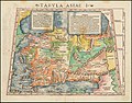 Tabula Asiae I (1542).jpg 1,732 × 1,350; 684 KB
-
 Tabula Asiae I - 1542.jpg 9,238 × 7,043; 15.64 MB
-
 Tabula Asiae I.jpg 1,772 × 1,350; 569 KB
-
 Battista Agnese. Black Sea. HM 26. PORTOLAN ATLAS Italy, ca. 1544.E.jpg 1,317 × 712; 339 KB
-
 Cosmographia - Beschreibung aller Lender durch Sebastianum Munsterum (1545) 25.jpg 11,027 × 7,154; 7.76 MB
-
 Nova Graecia XXII Nova Tabula.jpg 9,200 × 7,030; 9.26 MB
-
 Europe and northern Africa. HM 29. PORTOLAN ATLAS, anonymous (Dieppe, 1547).J.jpg 2,334 × 1,998; 1.61 MB
-
 Europe and northern Africa. HM 29. PORTOLAN ATLAS, anonymous (Dieppe, 1547).R.jpg 1,000 × 1,131; 441 KB
-

-

-
 Battista Agnese. Black Sea. HM 25. PORTOLAN ATLAS Italy, ca. 1540.B.jpg 965 × 668; 245 KB
-
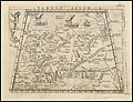 Tabula Asiae I by Giacomo Gastaldi.jpg 1,557 × 1,200; 432 KB
.jpg)


_25.jpg)

.J.jpg)
.R.jpg)
.M.jpg)
.G.jpg)

