Category:1520s maps of the Caucasus
Jump to navigation
Jump to search
Media in category "1520s maps of the Caucasus"
The following 13 files are in this category, out of 13 total.
-

-
 A map of Russia by Battist Agneze, 1525. Text p.3.jpg 760 × 572; 120 KB
-
 Agnese.jpg 805 × 1,173; 269 KB
-
 Paolo Giovio map (1525).jpg 1,256 × 1,745; 648 KB
-
 Piri Reis. Map of the Black Sea.jpg 10,592 × 6,974; 49.79 MB
-
 Tabula III Asiae.jpg 11,106 × 8,655; 12.65 MB
-
 Map Diego Ribero 1529 Asia.jpg 815 × 597; 503 KB
-
 Map Diego Ribero 1529.B.jpg 1,200 × 1,200; 233 KB
-
 Map Diego Ribero 1529.D.jpg 6,200 × 6,200; 2.06 MB
-
 Map Diego Ribero 1529.I.jpg 902 × 811; 119 KB
-
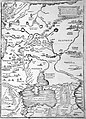
 Armeniamap1.jpg 515 × 409; 71 KB
-
 Map Diego Ribero 1529.C.jpg 6,200 × 6,200; 1.38 MB
-
 Map Diego Ribero 1529.H.jpg 1,301 × 735; 158 KB


.jpg)


