Category:1513 maps of Africa
Jump to navigation
Jump to search
Media in category "1513 maps of Africa"
The following 18 files are in this category, out of 18 total.
-
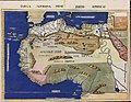
 Tabula Moderna Prime Partis Aphricae by Martin Waldseemüller.jpg 14,784 × 11,063; 34.31 MB
-
 1513 map of North Africa by Martin Waldseemüller.jpg 14,200 × 10,449; 26.43 MB
-
 1513 map of North and West Africa by Martin Waldseemüller.jpg 14,110 × 10,533; 32.1 MB
-
 1513 map of West a nd North Africa by Martin Waldseemüller.jpg 14,150 × 10,642; 28.94 MB
-
 1513 Ptolemy's 4th African Map by Martin Waldseemüller.jpg 14,430 × 10,362; 24.61 MB
-
 Nile-Cairo-Giza.jpg 584 × 846; 314 KB
-
 Tabula Moderna Secunde Porcionis Aphricae.jpg 14,062 × 10,326; 23.46 MB
-
 Tabula Quarta Africae, colored.jpg 14,430 × 10,362; 24.61 MB
-
 Tabula Quarta Africae.jpg 14,682 × 10,429; 19 MB
-
 Tabula Terre Nove (NYPL Hades-118522-54646).tif 5,086 × 4,201; 61.14 MB
-
 Tabula Terre Nove.jpg 2,000 × 1,743; 2.2 MB
-

-

-
 Tabvla Prima Africae - DPLA - 47d33a1ab436a8c4d757d9769b78f822.jpg 1,001 × 645; 168 KB
-
 Tabvla Qvarta Africae - DPLA - 91a6fb43f2234f995543f43e665ba2be.jpg 1,000 × 661; 193 KB
-
 Tabvla Secvnda Africae - DPLA - 3b285029c9c6fbb3b21927c34b78c9c8.jpg 1,000 × 659; 177 KB
-
 Tertia Africae Tabvla - DPLA - f912583918f77218e94356694bac4141.jpg 1,000 × 658; 170 KB
-
 Waldseemüller Tabula Moderna Prime Partis Africae 1513 UTA.jpg 3,024 × 2,340; 3.09 MB


