Category:1. Teich in Teichkaskade Chursdorf und Feuchtgebiet
Jump to navigation
Jump to search
 | |||||
| Upload media | |||||
| Instance of | |||||
|---|---|---|---|---|---|
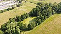
| Location | Penig, Mittelsachsen, Saxony, Germany | ||||
| Start time |
| ||||
| Area |
| ||||
 | |||||
Media in category "1. Teich in Teichkaskade Chursdorf und Feuchtgebiet"
The following 2 files are in this category, out of 2 total.
-
 FND 1. Teich in Teichkaskade Chursdorf und Feuchtgebiet DJI 0203.jpg 4,000 × 2,250; 3.83 MB
-
 FND 1. Teich in Teichkaskade Chursdorf und Feuchtgebiet DJI 0204.jpg 4,000 × 2,250; 3.71 MB
