Category:Østofte Kirke
Jump to navigation
Jump to search
| Object location | | View all coordinates using: OpenStreetMap |
|---|
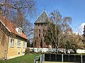
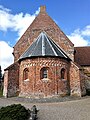
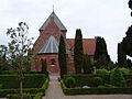
church building in Lolland Municipality, Denmark  | |||||
| Upload media | |||||
| Instance of | |||||
|---|---|---|---|---|---|
| Location | Østofte, Lolland Municipality, Region Zealand, Denmark | ||||
| Street address |
| ||||
| Diocese | |||||
| Religion or worldview | |||||
 | |||||
Media in category "Østofte Kirke"
The following 11 files are in this category, out of 11 total.
-
 Nordenskirker oestoftex01.jpg 808 × 536; 138 KB
-
 Ørstofte Kirke, Fuglse Herred, Laaland.jpg 3,381 × 2,705; 1.38 MB
-
 Østofte Kirke 02.jpg 5,120 × 3,840; 6.17 MB
-
 Østofte kirke 02.jpg 3,840 × 5,120; 7.44 MB
-
 Østofte Kirke 2023, fra landevej.jpg 4,032 × 3,024; 2.6 MB
-
 Østofte Kirke 2023, tårn.jpg 4,032 × 3,024; 4.32 MB
-
 Østofte kirke, apse.jpg 3,840 × 5,120; 6.12 MB
-
 Østofte Kirke.JPG 3,264 × 2,448; 3.42 MB
-
 Østofte Kirke1.JPG 3,264 × 2,448; 3.3 MB
-
 Østofte Kirke2.JPG 3,264 × 2,448; 3.54 MB
-
 Østofte, Nørreballe kirke (Lolland).jpg 784 × 599; 377 KB


.jpg)