Category:Étangs de Commelles
Jump to navigation
Jump to search
| Object location | | View all coordinates using: OpenStreetMap |
|---|
lake  | |||||
| Upload media | |||||
| Instance of | |||||
|---|---|---|---|---|---|
| Location |
| ||||
| Width |
| ||||
| Length |
| ||||
| Area |
| ||||
| Elevation above sea level |
| ||||
| Inflows | |||||
 | |||||
Subcategories
This category has the following 2 subcategories, out of 2 total.
C
Media in category "Étangs de Commelles"
The following 37 files are in this category, out of 37 total.
-

-
 Chateaureineblancheneige.jpg 2,080 × 1,544; 669 KB
-
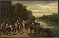
 Château de Chantilly, Louis Godefroy Jadin, deer hunting.JPG 3,369 × 2,694; 2.03 MB
-
 Commelle.JPG 1,024 × 766; 140 KB
-
 Commelleautomne.JPG 1,024 × 766; 173 KB
-

-

-

-

-
 Coye-la-Forêt (60), monument de 1985 en mémoire de l'ancien viaduc ferroviaire de 1853.jpg 3,664 × 2,748; 1.92 MB
-
 Coye-la-Forêt (60), étangs de Commelles, extrémité sud-ouest, vue vers le nord-est.jpg 3,648 × 2,736; 962 KB
-

-

-
 Etangdelalogedeviarmes.JPG 1,024 × 766; 156 KB
-
 Etangneuf2.JPG 1,024 × 766; 122 KB
-
 Etangs de Commelle - Anastasi - Musée Condé PE525.jpg 629 × 445; 36 KB
-
 Etangs de Commelles dans la forêt de Chantilly, près de Coye-la-Forêt (60).jpg 3,664 × 2,748; 1.69 MB
-
 Etangs de Commelles.JPG 3,840 × 2,880; 2.02 MB
-
 Etangscommellematin.jpg 2,288 × 1,712; 743 KB
-
 Etangscommelleneige.jpg 2,080 × 1,544; 606 KB
-
 Forêt de Chantilly (60), déversoir de l'Étang Chapron dans l'Étang Neuf.jpg 3,664 × 2,748; 1.72 MB
-
 Forêt de Chantilly (60), étangs de Comelles, Etang Neuf.jpg 3,664 × 2,748; 2.1 MB
-

-
 Ileetangscommelle.JPG 1,024 × 766; 167 KB
-
 Les Etangs de Commelles.jpg 1,600 × 1,200; 460 KB
-
 Les étangs de Commelle - Anastasi - Musée Condé PE526.jpg 758 × 455; 53 KB
-
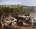
 L’hallali aux étangs de Commelles - Ladurner - Musée Condé.jpg 758 × 492; 51 KB
-

-
 Plan des étangs de Commelle, de la Loge Chaperon, de la Loge de Vierme - btv1b53006817v.jpg 9,900 × 4,166; 8.37 MB
-
 Quatrièmeetangscommelle.JPG 1,024 × 766; 177 KB
-
 Reineblancheetangloge.JPG 1,024 × 766; 157 KB
-
 Routedesétangs.JPG 766 × 1,024; 183 KB
-
 ScultureancienviaducCommelle.JPG 1,024 × 766; 167 KB
-
 Vanne etangs de Commelles.JPG 3,840 × 2,880; 2.14 MB
-
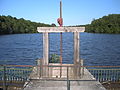
 Vanneetangscommelle.JPG 1,024 × 766; 163 KB
-
 Étangs de Commelles Étang Neuf route.jpg 4,608 × 3,456; 9.71 MB
-
 Étangs de Commelles Étang Neuf.jpg 4,608 × 3,456; 3.51 MB
,_mus%C3%A9e_Cond%C3%A9,_Louis-Godefroy_Jadin,_Hallali_du_cerf_aux_%C3%A9tangs_de_Commelle.jpg)


,_ch%C3%A2teau_de_la_Reine_Blanche,_vue_depuis_le_sud,_et_%C3%A9tangs_de_Commelles.jpg)
,_for%C3%AAt_de_Coye,_%C3%A9tangs_de_Commelles_-_%C3%A9tang_de_la_Loge,_vestiges_d%27une_vanne_proche_de_la_digue_en_amont.jpg)
,_for%C3%AAt_de_Coye,_%C3%A9tangs_de_Commelles_-_%C3%A9tang_de_la_Loge,_vue_vers_le_nord-est_1.jpg)
,_for%C3%AAt_de_Coye,_%C3%A9tangs_de_Commelles_-_%C3%A9tang_de_la_Loge,_vue_vers_le_nord-est_2.jpg)
,_monument_de_1985_en_m%C3%A9moire_de_l%27ancien_viaduc_ferroviaire_de_1853.jpg)
,_%C3%A9tangs_de_Commelles,_extr%C3%A9mit%C3%A9_sud-ouest,_vue_vers_le_nord-est.jpg)
,_%C3%A9tangs_de_Commelles,_vue_vers_l%27est_depuis_la_digue_finale_pr%C3%A8s_du_ch%C3%A2teau_de_la_Reine_Blanche_1.jpg)
,_%C3%A9tangs_de_Commelles,_vue_vers_l%27est_depuis_la_digue_finale_pr%C3%A8s_du_ch%C3%A2teau_de_la_Reine_Blanche_2.jpg)


.jpg)


,_d%C3%A9versoir_de_l%27%C3%89tang_Chapron_dans_l%27%C3%89tang_Neuf.jpg)
,_%C3%A9tangs_de_Comelles,_Etang_Neuf.jpg)
,_%C3%A9tangs_de_Comelles,_pont_dans_la_digue_entre_Etang_Neuf_et_Etang_de_la_Loge_17.10.2010_03.jpg)


,_%C3%A9tangs_de_Commelles_-_%C3%A9tang_Chapron,_vue_vers_le_nord-est_depuis_la_digue.jpg)


