Category:Étang d'Amaury
Jump to navigation
Jump to search
| Object location | | View all coordinates using: OpenStreetMap |
|---|

.JPG) | |||||
| Upload media | |||||
| Instance of | |||||
|---|---|---|---|---|---|
| Location |
| ||||
| Area |
| ||||
 | |||||
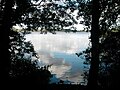
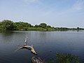
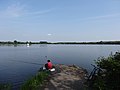
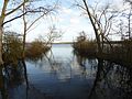
Français : L'étang d'Amaury est un lac d'affaissement minier situé près des fosses Sophie, Laurent et Amaury de la Compagnie des mines d'Anzin dans le bassin minier du Nord-Pas-de-Calais, Hergnies et Vieux-Condé, Nord, Nord-Pas-de-Calais, France. L'étang d'Amaury est inscrit sur la liste du patrimoine mondial par l'Unesco le 30 juin 2012 et y constitue en partie le site no 5.
Media in category "Étang d'Amaury"
The following 12 files are in this category, out of 12 total.
-
 Eau eau.jpg 404 × 303; 36 KB
-
 Etang d'Amaury, MG 1980-1-3.jpg 3,456 × 5,184; 8.48 MB
-
 Etang d'Amaury, MG 6984-1-2.jpg 5,139 × 3,426; 8.58 MB
-
 Hergnies - Étang d'Amaury (01).JPG 4,896 × 3,672; 6.91 MB
-
 Hergnies - Étang d'Amaury (02).JPG 4,896 × 3,672; 6.92 MB
-
 Hergnies - Étang d'Amaury (03).JPG 4,896 × 3,672; 7.05 MB
-
 Hergnies - Étang d'Amaury (04).JPG 4,896 × 3,672; 5.14 MB
-
 Hergnies - Étang d'Amaury (05).JPG 4,896 × 3,672; 4.39 MB
-
 Hergnies - Étang d'Amaury (06).JPG 4,896 × 3,672; 4.13 MB
-
 Hergnies - Étang d'Amaury (07).JPG 4,912 × 1,080; 1.68 MB
-
 Hergnies Étang d'Amaury (1).JPG 4,701 × 3,527; 3.62 MB
-
 Hergnies Étang d'Amaury (2).JPG 3,986 × 3,091; 3.41 MB


.JPG)
.JPG)
.JPG)
.JPG)
.JPG)
.JPG)
.JPG)
.JPG)