Category:Église Saint-Willibrord (Lipperscheid)
Jump to navigation
Jump to search
| Object location | | View all coordinates using: OpenStreetMap |
|---|
 | |||||
| Upload media | |||||
| Instance of | |||||
|---|---|---|---|---|---|
| Location |
| ||||
 | |||||
Subcategories
This category has the following 3 subcategories, out of 3 total.
Media in category "Église Saint-Willibrord (Lipperscheid)"
The following 14 files are in this category, out of 14 total.
-
 Hunn Lëppscht.jpg 5,856 × 3,908; 11.13 MB
-
 Kierch Lëpscht-001.jpg 6,868 × 4,584; 13.8 MB
-
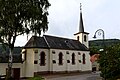 Kierch Lëpscht.jpg 6,771 × 4,518; 18.39 MB
-
 Lëppschent bannen.jpg 3,952 × 2,625; 7.26 MB
-
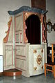 Lëppschent Beichtstull.jpg 2,484 × 3,740; 6.74 MB
-
 Lëppschent Jousefs Statu-001.jpg 2,551 × 3,841; 7.21 MB
-
 Lëppschent Jousefs Statu.jpg 2,531 × 3,812; 6.83 MB
-
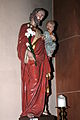
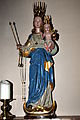 Lëppschent Muttergottes Statu.jpg 2,652 × 3,993; 7.85 MB
-
 Lëppschent Willibrord bannen-001.jpg 2,627 × 3,956; 7.16 MB
-
 Lëppschent Willibrord bannen.jpg 2,699 × 4,064; 7.53 MB
-
 Lëppschent Willibrord baussen.jpg 2,228 × 3,355; 5.77 MB
-
 Lëpscht Chouer.jpg 3,864 × 2,567; 7 MB
-
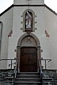 Lëpscht Portal Kierch.jpg 2,689 × 4,048; 6.87 MB
-
 Willibrod zu Lëppscht iwwer der Entree.jpg 1,620 × 2,439; 3.12 MB


