Category:Église Saint-Lambert (Eppeldorf)
Jump to navigation
Jump to search
| Object location | | View all coordinates using: OpenStreetMap |
|---|
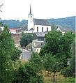
church building in Vallée de l'Ernz, Luxembourg   | |||||
| Upload media | |||||
| Instance of | |||||
|---|---|---|---|---|---|
| Location | Eppeldorf, Vallée de l'Ernz, Canton of Diekirch, Luxembourg | ||||
| Heritage designation |
| ||||
 | |||||
Media in category "Église Saint-Lambert (Eppeldorf)"
The following 3 files are in this category, out of 3 total.
-
 Eppeldorf and church.jpg 1,729 × 1,895; 415 KB
-
 Eppeldorf church inside.jpg 1,932 × 1,286; 708 KB
-
 Eppeldorf church.jpg 1,292 × 1,556; 732 KB
